Lupao geodata
Lupao (Central Luzon) is a seat of a third-order administrative division; located in Philippines in Asia/Manila (GMT+8) time zone. With population of 11,000 people, there are 563 cities with bigger population in this country. Compared to other cities in Philippines, 85.8% of cities are located further ↓South; 79.5% of cities are located further →East and 85.6% of cities have lower elevation than Lupao. Note1


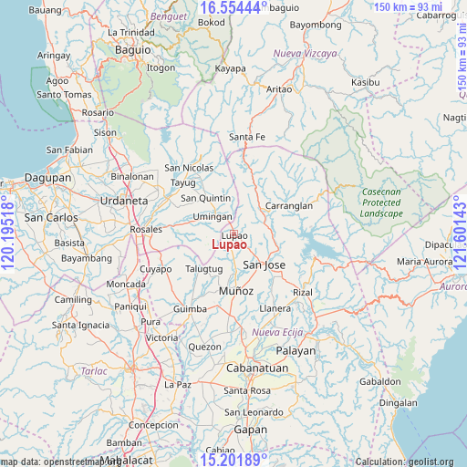
Lupao GPS coordinates[2]
15° 52' 45.48" North, 120° 53' 53.88" East
| Map corner | latitude | longitude |
|---|---|---|
| Upper-left | 16.55444°, | 120.19518° |
| Center: | 15.8793°, | 120.8983° |
| Lower-right: | 15.20189°, | 121.60143° |
| Map W x H: | 150.4×150.4 km | = 93.5×93.5mi |
| max Lat: | 20.78733° ⇑14.2% North |
| Lupao: | 15.8793° |
| min Lat: | ⇓85.8% South 4.65442° |
| min Long | Lupao | max Long |
| 117.04868° | 120.8983° | 126.58417° |
| W 20.5%⇐ | ⇒79.5% E |
Elevation
Elevation of Lupao is 146 m = 479 ft, and this is 58.1 m = 191 ft above average elevation for this country.
| Max E: |
2262 m = 7421 ft | 14.4% |
| Lupao | 146 m 479 ft | |
| Avg. | 87.9 m = 288 ft | |
Min E: |
-2 m = -7 ft | 85.6% |
See also: Philippines elevation on elevation.city.
Geographical zone
Lupao is located in North Torrid zone (between Equator and Tropic of Cancer). Distance of this Northern Tropic circle is 840.3 km =522.1 mi to North.| Distance of | km | miles | from Lupao |
|---|---|---|---|
| North Pole | 8241.4 | 5121 | to North |
| Arctic Circle | 5635.6 | 3501.8 | to North |
| Tropic Cancer | 840.3 | 522.1 | to North |
| Equator | 1765.6 | 1097.1 | to South |


Nearby cities:
15 places around Lupao: (largest is in red/bold)
• Alac
15.5 km =9.6 mi,  320°
320°
• Diaz
7.7 km =4.8 mi,  241°
241°
• Digdig
11.5 km =7.1 mi,  47°
47°
• Magtangol
13.6 km =8.5 mi,  172°
172°
• Nancalobasaan
8.5 km =5.3 mi, 315°
• Parista
4.3 km =2.7 mi,  131°
131°
• Puncan
10.4 km =6.5 mi,  72°
72°
• Salvacion I
4.8 km =3 mi,  156°
156°
• Sampaloc
7.7 km =4.8 mi,  205°
205°
• San Quintin
14.9 km =9.3 mi, 322°
• Sibul
14 km =8.7 mi, 129°
• Talugtug
14.6 km =9.1 mi,  219°
219°
• Tayabo
15 km =9.3 mi,  109°
109°
• Umingan
10.9 km =6.8 mi,  282°
282°
• Villa Isla
12.6 km =7.8 mi,  195°
195°
Sources, notices
• [Note1] Compared only with cities in Philippines existing in our database
• [Src1] Map data: © OpenStreetMap contributors (CC-BY-SA)
• [Src2] Other city data from geonames.org with taken over terms of usage.
• [Src3] Geographical zone / Annual Mean Temperature by Robert A. Rohde @ Wikipedia
