Palayan City geodata
Palayan City (Central Luzon) is a populated place; located in Philippines in Asia/Manila (GMT+8) time zone. With population of 23,742 people, there are 333 cities with bigger population in this country. Compared to other cities in Philippines, 82% of cities are located further ↓South; 74.3% of cities are located further →East and 76.2% of cities have lower elevation than Palayan City. Note1
Administrative division(s):
- Level 1: Central Luzon
- Level 2: Province of Nueva Ecija
- Level 3: Palayan City


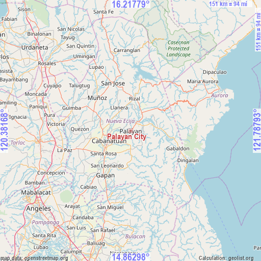
Palayan City GPS coordinates[2]
15° 32' 29.4" North, 121° 5' 5.28" East
| Map corner | latitude | longitude |
|---|---|---|
| Upper-left | 16.21779°, | 120.38168° |
| Center: | 15.5415°, | 121.0848° |
| Lower-right: | 14.86298°, | 121.78793° |
| Map W x H: | 150.6×150.6 km | = 93.6×93.6mi |
| max Lat: | 20.78733° ⇑18% North |
| Palayan City: | 15.5415° |
| min Lat: | ⇓82% South 4.65442° |
| min Long | Palayan City | max Long |
| 117.04868° | 121.0848° | 126.58417° |
| W 25.7%⇐ | ⇒74.3% E |
Elevation
Elevation of Palayan City is 73 m = 240 ft, and this is 14.9 m = 49 ft below average elevation for this country.
| Max E: |
2262 m = 7421 ft | 23.8% |
| Avg. | 87.9 m = 288 ft | |
| Palayan City | 73 m = 240 ft | |
Min E: |
-2 m = -7 ft | 76.2% |
See also: Philippines elevation on elevation.city.
Geographical zone
Palayan City is located in North Torrid zone (between Equator and Tropic of Cancer). Distance of this Northern Tropic circle is 877.9 km =545.5 mi to North.| Distance of | km | miles | from Palayan City |
|---|---|---|---|
| North Pole | 8279 | 5144.3 | to North |
| Arctic Circle | 5673.1 | 3525.1 | to North |
| Tropic Cancer | 877.9 | 545.5 | to North |
| Equator | 1728.1 | 1073.8 | to South |


Nearby cities:
15 places around Palayan City: (largest is in red/bold)
• Antipolo
14.1 km =8.8 mi,  52°
52°
• Bangad
7.6 km =4.7 mi,  234°
234°
• Bicos
14 km =8.7 mi,  340°
340°
• Bongabon
11.9 km =7.4 mi,  32°
32°
• Buliran
13.4 km =8.3 mi,  272°
272°
• General Mamerto Natividad
7.7 km =4.8 mi,  332°
332°
• Laur
11.7 km =7.3 mi,  64°
64°
• Mabini
12.7 km =7.9 mi,  300°
300°
• Macatbong
4.1 km =2.5 mi,  188°
188°
• Mapalad
10 km =6.2 mi,  180°
180°
• Paco Roman
13.1 km =8.1 mi,  1°
1°
• Piñahan
9.8 km =6.1 mi,  345°
345°
• Sagana
7.8 km =4.8 mi,  67°
67°
• San Ricardo
13.4 km =8.3 mi, 296°
• Sapang Buho
6.9 km =4.3 mi,  38°
38°
Sources, notices
• [Note1] Compared only with cities in Philippines existing in our database
• [Src1] Map data: © OpenStreetMap contributors (CC-BY-SA)
• [Src2] Other city data from geonames.org with taken over terms of usage.
• [Src3] Geographical zone / Annual Mean Temperature by Robert A. Rohde @ Wikipedia
