General Mamerto Natividad geodata
General Mamerto Natividad (Central Luzon) is a populated place; located in Philippines in Asia/Manila (GMT+8) time zone. With population of 18,393 people, there are 389 cities with bigger population in this country. Compared to other cities in Philippines, 82.9% of cities are located further ↓South; 75.1% of cities are located further →East and 72.8% of cities have lower elevation than General Mamerto Natividad. Note1
Administrative division(s):
- Level 1: Central Luzon
- Level 2: Province of Nueva Ecija
- Level 3: General Mamerto Natividad
Current local time in General Mamerto Natividad:
01:51 AM, TuesdayDifference from your time zone: hours


General Mamerto Natividad GPS coordinates[2]
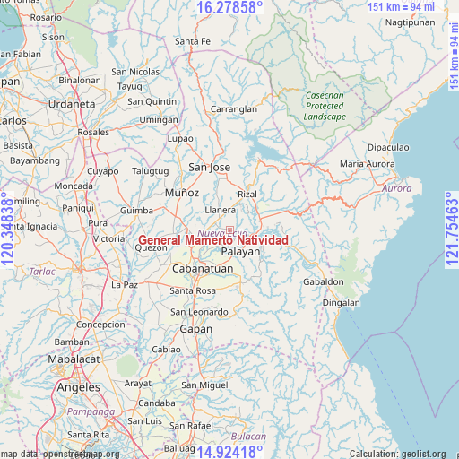
15° 36' 9" North, 121° 3' 5.4" East
| Map corner | latitude | longitude |
|---|---|---|
| Upper-left | 16.27858°, | 120.34838° |
| Center: | 15.6025°, | 121.0515° |
| Lower-right: | 14.92418°, | 121.75463° |
| Map W x H: | 150.6×150.6 km | = 93.6×93.6mi |
| max Lat: | 20.78733° ⇑17.1% North |
| General Mamerto Natividad: | 15.6025° |
| min Lat: | ⇓82.9% South 4.65442° |
| min Long | General Mamerto | max Long |
| 117.04868° | 121.0515° | 126.58417° |
| W 24.9%⇐ | ⇒75.1% E |
Elevation
Elevation of General Mamerto Natividad is 60 m = 197 ft, and this is 27.9 m = 92 ft below average elevation for this country.
| Max E: |
2262 m = 7421 ft | 27.2% |
| Avg. | 87.9 m = 288 ft | |
| General Mamerto Natividad | 60 m = 197 ft | |
Min E: |
-2 m = -7 ft | 72.8% |
See also: Philippines elevation on elevation.city.
Geographical zone
General Mamerto Natividad is located in North Torrid zone (between Equator and Tropic of Cancer). Distance of this Northern Tropic circle is 871.1 km =541.3 mi to North.| Distance of | km | miles | from General Mamerto Natividad |
|---|---|---|---|
| North Pole | 8272.2 | 5140.1 | to North |
| Arctic Circle | 5666.3 | 3520.9 | to North |
| Tropic Cancer | 871.1 | 541.3 | to North |
| Equator | 1734.8 | 1078 | to South |


Nearby cities:
15 places around General Mamerto Natividad: (largest is in red/bold)
• Agbannawag
9.2 km =5.7 mi,  21°
21°
• Bangad
11.5 km =7.1 mi,  192°
192°
• Bicos
6.5 km =4 mi,  350°
350°
• Bongabon
10.5 km =6.5 mi,  71°
71°
• Del Pilar
11 km =6.8 mi, 19°
• Llanera
7.7 km =4.8 mi,  332°
332°
• Mabini
7.3 km =4.5 mi,  267°
267°
• Macatbong
11.3 km =7 mi,  164°
164°
• Paco Roman
7.4 km =4.6 mi,  31°
31°
• Palayan City
7.7 km =4.8 mi,  152°
152°
• Piñahan
2.9 km =1.8 mi, 22°
• Plaridel
7.1 km =4.4 mi, 331°
• Sagana
11.4 km =7.1 mi,  109°
109°
• San Ricardo
8.5 km =5.3 mi, 265°
• Sapang Buho
7.9 km =4.9 mi,  99°
99°
Sources, notices
• [Note1] Compared only with cities in Philippines existing in our database
• [Src1] Map data: © OpenStreetMap contributors (CC-BY-SA)
• [Src2] Other city data from geonames.org with taken over terms of usage.
• [Src3] Geographical zone / Annual Mean Temperature by Robert A. Rohde @ Wikipedia
