Namuac geodata
Namuac (Cagayan Valley) is a populated place; located in Philippines in Asia/Manila (GMT+8) time zone. With population of 3,037 people, there are 2485 cities with bigger population in this country. Compared to other cities in Philippines, 99.9% of cities are located further ↓South; 72.2% of cities are located further →East and 73.2% of cities have higher elevation than Namuac. Note1
Administrative division(s):
- Level 1: Cagayan Valley
- Level 2: Province of Cagayan
- Level 3: Sanchez-Mira


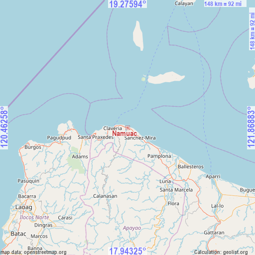
Namuac GPS coordinates[2]
18° 36' 39.24" North, 121° 9' 56.52" East
| Map corner | latitude | longitude |
|---|---|---|
| Upper-left | 19.27594°, | 120.46258° |
| Center: | 18.6109°, | 121.1657° |
| Lower-right: | 17.94325°, | 121.86883° |
| Map W x H: | 148.2×148.2 km | = 92.1×92.1mi |
| max Lat: | 20.78733° ⇑0.1% North |
| Namuac: | 18.6109° |
| min Lat: | ⇓99.9% South 4.65442° |
| min Long | Namuac | max Long |
| 117.04868° | 121.1657° | 126.58417° |
| W 27.8%⇐ | ⇒72.2% E |
Elevation
Elevation of Namuac is 11 m = 36 ft, and this is 76.9 m = 252 ft below average elevation for this country.
| Max E: |
2262 m = 7421 ft | 73.2% |
| Avg. | 87.9 m = 288 ft | |
| Namuac | 11 m = 36 ft | |
Min E: |
-2 m = -7 ft | 26.8% |
See also: Philippines elevation on elevation.city.
Geographical zone
Namuac is located in North Torrid zone (between Equator and Tropic of Cancer). Distance of this Northern Tropic circle is 536.6 km =333.4 mi to North.| Distance of | km | miles | from Namuac |
|---|---|---|---|
| North Pole | 7937.7 | 4932.3 | to North |
| Arctic Circle | 5331.8 | 3313 | to North |
| Tropic Cancer | 536.6 | 333.4 | to North |
| Equator | 2069.3 | 1285.8 | to South |


Nearby cities:
15 places around Namuac: (largest is in red/bold)
• Abulug
35.5 km =22.1 mi,  121°
121°
• Adams
32.3 km =20.1 mi,  240°
240°
• Bagu
28.8 km =17.9 mi,  135°
135°
• Bangui
42.8 km =26.6 mi,  259°
259°
• Cabaritan East
40.3 km =25 mi, 122°
• Calanasan
41.9 km =26 mi,  199°
199°
• Calog Norte
36 km =22.4 mi, 139°
• Claveria
8.7 km =5.4 mi,  267°
267°
• Dumalneg
38.7 km =24 mi, 255°
• Lucban
41.4 km =25.7 mi, 137°
• Luna
37.4 km =23.2 mi,  147°
147°
• Pagudpud
40.3 km =25 mi, 262°
• Pamplona
24.5 km =15.2 mi,  130°
130°
• Santa Cruz
18.5 km =11.5 mi, 124°
• Santa Praxedes
18.1 km =11.2 mi,  254°
254°
Sources, notices
• [Note1] Compared only with cities in Philippines existing in our database
• [Src1] Map data: © OpenStreetMap contributors (CC-BY-SA)
• [Src2] Other city data from geonames.org with taken over terms of usage.
• [Src3] Geographical zone / Annual Mean Temperature by Robert A. Rohde @ Wikipedia
