Mandaue City geodata
Mandaue City (Central Visayas) is a seat of a third-order administrative division; located in Philippines in Asia/Manila (GMT+8) time zone. With population of 331,320 people, there are 24 cities with bigger population in this country. Compared to other cities in Philippines, 64.9% of cities are located further ↑North; 69.7% of cities are located further ←West and 89.7% of cities have higher elevation than Mandaue City. Note1
Administrative division(s):
- Level 1: Central Visayas
- Level 2: Province of Cebu
- Level 3: Mandaue City


Mandaue City GPS coordinates[2]
10° 19' 24.996" North, 123° 55' 19.992" East
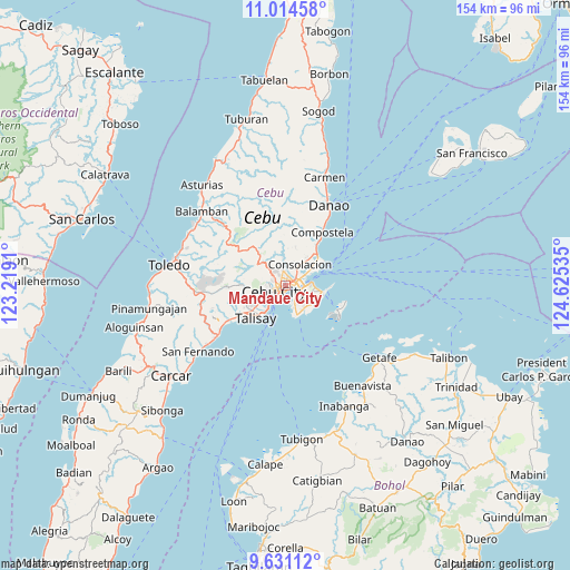
| Map corner | latitude | longitude |
|---|---|---|
| Upper-left | 11.01458°, | 123.2191° |
| Center: | 10.32361°, | 123.92222° |
| Lower-right: | 9.63112°, | 124.62535° |
| Map W x H: | 153.8×153.8 km | = 95.6×95.6mi |
| max Lat: | 20.78733° ⇑64.9% North |
| Mandaue City: | 10.32361° |
| min Lat: | ⇓35.1% South 4.65442° |
| min Long | Mandaue City | max Long |
| 117.04868° | 123.92222° | 126.58417° |
| W 69.7%⇐ | ⇒30.3% E |
Elevation
Elevation of Mandaue City is 7 m = 23 ft, and this is 80.9 m = 265 ft below average elevation for this country.
| Max E: |
2262 m = 7421 ft | 89.7% |
| Avg. | 87.9 m = 288 ft | |
| Mandaue City | 7 m = 23 ft | |
Min E: |
-2 m = -7 ft | 10.3% |
See also: Mandaue City elevation on elevation.city.
Geographical zone
Mandaue City is located in North Torrid zone (between Equator and Tropic of Cancer). Distance of Equator is 1147.9 km =713.3 mi to South.| Distance of | km | miles | from Mandaue City |
|---|---|---|---|
| North Pole | 8859.2 | 5504.8 | to North |
| Arctic Circle | 6253.3 | 3885.6 | to North |
| Tropic Cancer | 1458 | 906 | to North |
| Equator | 1147.9 | 713.3 | to South |


Nearby cities:
15 places around Mandaue City: (largest is in red/bold)
• Adlaon
3.6 km =2.2 mi,  222°
222°
• Apas
2.9 km =1.8 mi,  311°
311°
• Baugo
0.8 km =0.5 mi,  207°
207°
• Buagsong
8.1 km =5 mi,  166°
166°
• Calero
9.9 km =6.2 mi,  56°
56°
• Cebu City
3.5 km =2.2 mi,  257°
257°
• Consolacion
7 km =4.3 mi,  33°
33°
• Cordova
9.1 km =5.7 mi, 166°
• Dapitan
7.4 km =4.6 mi,  156°
156°
• Gabi
8 km =5 mi,  147°
147°
• Jaclupan
11.8 km =7.3 mi, 257°
• Lapu-Lapu City
3.3 km =2.1 mi,  116°
116°
• Talisay
11.8 km =7.3 mi, 222°
• Tangke
9.9 km =6.2 mi, 219°
• Tayud
11 km =6.8 mi, 55°
Sources, notices
• [Note1] Compared only with cities in Philippines existing in our database
• [Src1] Map data: © OpenStreetMap contributors (CC-BY-SA)
• [Src2] Other city data from geonames.org with taken over terms of usage.
• [Src3] Geographical zone / Annual Mean Temperature by Robert A. Rohde @ Wikipedia
