Calero geodata
Calero (Central Visayas) is a populated place; located in Philippines in Asia/Manila (GMT+8) time zone. With population of 3,232 people, there are 2273 cities with bigger population in this country. Compared to other cities in Philippines, 64.5% of cities are located further ↑North; 70.8% of cities are located further ←West and 85.4% of cities have higher elevation than Calero. Note1


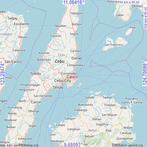
Calero GPS coordinates[2]
10° 22' 23.916" North, 123° 59' 52.296" East
| Map corner | latitude | longitude |
|---|---|---|
| Upper-left | 11.06416°, | 123.29474° |
| Center: | 10.37331°, | 123.99786° |
| Lower-right: | 9.68093°, | 124.70099° |
| Map W x H: | 153.8×153.8 km | = 95.6×95.6mi |
| max Lat: | 20.78733° ⇑64.5% North |
| Calero: | 10.37331° |
| min Lat: | ⇓35.5% South 4.65442° |
| min Long | Calero | max Long |
| 117.04868° | 123.99786° | 126.58417° |
| W 70.8%⇐ | ⇒29.2% E |
Elevation
Elevation of Calero is 8 m = 26 ft, and this is 79.9 m = 262 ft below average elevation for this country.
| Max E: |
2262 m = 7421 ft | 85.4% |
| Avg. | 87.9 m = 288 ft | |
| Calero | 8 m = 26 ft | |
Min E: |
-2 m = -7 ft | 14.6% |
See also: Philippines elevation on elevation.city.
Geographical zone
Calero is located in North Torrid zone (between Equator and Tropic of Cancer). Distance of Equator is 1153.4 km =716.7 mi to South.| Distance of | km | miles | from Calero |
|---|---|---|---|
| North Pole | 8853.7 | 5501.4 | to North |
| Arctic Circle | 6247.8 | 3882.2 | to North |
| Tropic Cancer | 1452.5 | 902.5 | to North |
| Equator | 1153.4 | 716.7 | to South |


Nearby cities:
15 places around Calero: (largest is in red/bold)
• Adlaon
13.5 km =8.4 mi,  232°
232°
• Agsungot
12.1 km =7.5 mi,  304°
304°
• Apas
11 km =6.8 mi,  250°
250°
• Baugo
10.6 km =6.6 mi, 234°
• Cebu City
13.3 km =8.3 mi,  241°
241°
• Compostela
9.2 km =5.7 mi,  8°
8°
• Consolacion
4.5 km =2.8 mi,  274°
274°
• Dapitan
13.4 km =8.3 mi,  203°
203°
• Gabi
12.9 km =8 mi, 198°
• Kotkot
5.8 km =3.6 mi,  2°
2°
• Lapu-Lapu City
8.8 km =5.5 mi,  217°
217°
• Liloan
2.9 km =1.8 mi, 2°
• Magay
11.1 km =6.9 mi, 8°
• Mandaue City
9.9 km =6.2 mi, 236°
• Tayud
1.1 km =0.7 mi,  47°
47°
Sources, notices
• [Note1] Compared only with cities in Philippines existing in our database
• [Src1] Map data: © OpenStreetMap contributors (CC-BY-SA)
• [Src2] Other city data from geonames.org with taken over terms of usage.
• [Src3] Geographical zone / Annual Mean Temperature by Robert A. Rohde @ Wikipedia
