Mandaluyong City geodata
Mandaluyong City (Metro Manila) is a populated place; located in Philippines in Asia/Manila (GMT+8) time zone. With population of 305,576 people, there are 29 cities with bigger population in this country. Compared to other cities in Philippines, 74.5% of cities are located further ↓South; 75.4% of cities are located further →East and 51.1% of cities have lower elevation than Mandaluyong City. Note1
Administrative division(s):
- Level 1: Metro Manila
- Level 2: Eastern Manila District
- Level 3: City of Mandaluyong


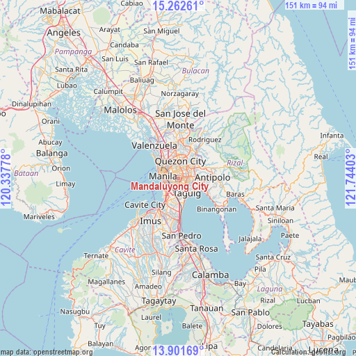
Mandaluyong City GPS coordinates[2]
14° 34' 59.52" North, 121° 2' 27.24" East
| Map corner | latitude | longitude |
|---|---|---|
| Upper-left | 15.26261°, | 120.33778° |
| Center: | 14.5832°, | 121.0409° |
| Lower-right: | 13.90169°, | 121.74403° |
| Map W x H: | 151.3×151.3 km | = 94×94mi |
| max Lat: | 20.78733° ⇑25.5% North |
| Mandaluyong City: | 14.5832° |
| min Lat: | ⇓74.5% South 4.65442° |
| min Long | Mandaluyong Cit | max Long |
| 117.04868° | 121.0409° | 126.58417° |
| W 24.6%⇐ | ⇒75.4% E |
Elevation
Elevation of Mandaluyong City is 24 m = 79 ft, and this is 63.9 m = 210 ft below average elevation for this country.
| Max E: |
2262 m = 7421 ft | 48.9% |
| Avg. | 87.9 m = 288 ft | |
| Mandaluyong City | 24 m = 79 ft | |
Min E: |
-2 m = -7 ft | 51.1% |
See also: Mandaluyong City elevation on elevation.city.
Geographical zone
Mandaluyong City is located in North Torrid zone (between Equator and Tropic of Cancer). Distance of this Northern Tropic circle is 984.4 km =611.7 mi to North.| Distance of | km | miles | from Mandaluyong City |
|---|---|---|---|
| North Pole | 8385.6 | 5210.6 | to North |
| Arctic Circle | 5779.7 | 3591.3 | to North |
| Tropic Cancer | 984.4 | 611.7 | to North |
| Equator | 1621.5 | 1007.6 | to South |


Nearby cities:
15 places around Mandaluyong City: (largest is in red/bold)
• Antipolo
10 km =6.2 mi,  61°
61°
• Bagong Pagasa
8.9 km =5.5 mi,  354°
354°
• Cainta
8.8 km =5.5 mi,  93°
93°
• Calumpang
6.9 km =4.3 mi,  50°
50°
• Del Monte
7 km =4.3 mi,  339°
339°
• Makati City
3.8 km =2.4 mi,  193°
193°
• Manila
6.7 km =4.2 mi,  290°
290°
• Pasay
6.6 km =4.1 mi,  219°
219°
• Pasig City
2.2 km =1.4 mi,  79°
79°
• Pateros
6 km =3.7 mi,  145°
145°
• Port Area
8 km =5 mi,  270°
270°
• Quezon City
7.4 km =4.6 mi,  8°
8°
• Quiapo
6.5 km =4 mi, 286°
• San Juan
2 km =1.2 mi, 336°
• Taguig
7.7 km =4.8 mi, 147°
Sources, notices
• [Note1] Compared only with cities in Philippines existing in our database
• [Src1] Map data: © OpenStreetMap contributors (CC-BY-SA)
• [Src2] Other city data from geonames.org with taken over terms of usage.
• [Src3] Geographical zone / Annual Mean Temperature by Robert A. Rohde @ Wikipedia
