Malolos geodata
Malolos (Central Luzon) is a seat of a second-order administrative division; located in Philippines in Asia/Manila (GMT+8) time zone. With population of 198,748 people, there are 53 cities with bigger population in this country. Compared to other cities in Philippines, 76% of cities are located further ↓South; 82% of cities are located further →East and 80.7% of cities have higher elevation than Malolos. Note1
Administrative division(s):
- Level 1: Central Luzon
- Level 2: Province of Bulacan
- Level 3: City of Malolos


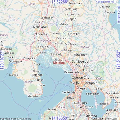
Malolos GPS coordinates[2]
14° 50' 39.48" North, 120° 48' 37.404" East
| Map corner | latitude | longitude |
|---|---|---|
| Upper-left | 15.52288°, | 120.10727° |
| Center: | 14.8443°, | 120.81039° |
| Lower-right: | 14.16359°, | 121.51352° |
| Map W x H: | 151.1×151.1 km | = 93.9×93.9mi |
| max Lat: | 20.78733° ⇑24% North |
| Malolos: | 14.8443° |
| min Lat: | ⇓76% South 4.65442° |
| min Long | Malolos | max Long |
| 117.04868° | 120.81039° | 126.58417° |
| W 18%⇐ | ⇒82% E |
Elevation
Elevation of Malolos is 9 m = 30 ft, and this is 78.9 m = 259 ft below average elevation for this country.
| Max E: |
2262 m = 7421 ft | 80.7% |
| Avg. | 87.9 m = 288 ft | |
| Malolos | 9 m = 30 ft | |
Min E: |
-2 m = -7 ft | 19.3% |
See also: Malolos elevation on elevation.city.
Geographical zone
Malolos is located in North Torrid zone (between Equator and Tropic of Cancer). Distance of this Northern Tropic circle is 955.4 km =593.7 mi to North.| Distance of | km | miles | from Malolos |
|---|---|---|---|
| North Pole | 8356.5 | 5192.5 | to North |
| Arctic Circle | 5750.6 | 3573.3 | to North |
| Tropic Cancer | 955.4 | 593.7 | to North |
| Equator | 1650.5 | 1025.6 | to South |


Nearby cities:
15 places around Malolos: (largest is in red/bold)
• Angat
9.3 km =5.8 mi,  127°
127°
• Balagtas
6.8 km =4.2 mi,  116°
116°
• Balite
6.2 km =3.9 mi,  336°
336°
• Balucuc
12.1 km =7.5 mi,  2°
2°
• Bulihan
9.8 km =6.1 mi,  69°
69°
• Calumpit
9.3 km =5.8 mi,  329°
329°
• Dampol
6.5 km =4 mi,  11°
11°
• Guiguinto
7.9 km =4.9 mi,  98°
98°
• Hagonoy
8.4 km =5.2 mi,  262°
262°
• Lambakin
12.1 km =7.5 mi,  150°
150°
• Manatal
12 km =7.5 mi, 72°
• Paombong
2.7 km =1.7 mi,  237°
237°
• Plaridel
6.9 km =4.3 mi,  46°
46°
• Pulilan
7.6 km =4.7 mi,  33°
33°
• Pulong Gubat
10.4 km =6.5 mi,  80°
80°
Sources, notices
• [Note1] Compared only with cities in Philippines existing in our database
• [Src1] Map data: © OpenStreetMap contributors (CC-BY-SA)
• [Src2] Other city data from geonames.org with taken over terms of usage.
• [Src3] Geographical zone / Annual Mean Temperature by Robert A. Rohde @ Wikipedia
