Ligaya geodata
Ligaya (Central Luzon) is a populated place; located in Philippines in Asia/Manila (GMT+8) time zone. With population of 5,299 people, there are 1199 cities with bigger population in this country. Compared to other cities in Philippines, 81.8% of cities are located further ↓South; 70.3% of cities are located further →East and 82.7% of cities have lower elevation than Ligaya. Note1
Administrative division(s):
- Level 1: Central Luzon
- Level 2: Province of Nueva Ecija
- Level 3: Gabaldon (Bitulok & Sabani)


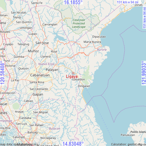
Ligaya GPS coordinates[2]
15° 30' 32.76" North, 121° 17' 13.92" East
| Map corner | latitude | longitude |
|---|---|---|
| Upper-left | 16.1855°, | 120.58408° |
| Center: | 15.5091°, | 121.2872° |
| Lower-right: | 14.83048°, | 121.99033° |
| Map W x H: | 150.7×150.7 km | = 93.6×93.6mi |
| max Lat: | 20.78733° ⇑18.2% North |
| Ligaya: | 15.5091° |
| min Lat: | ⇓81.8% South 4.65442° |
| min Long | Ligaya | max Long |
| 117.04868° | 121.2872° | 126.58417° |
| W 29.7%⇐ | ⇒70.3% E |
Elevation
Elevation of Ligaya is 113 m = 371 ft, and this is 25.1 m = 82 ft above average elevation for this country.
| Max E: |
2262 m = 7421 ft | 17.3% |
| Ligaya | 113 m 371 ft | |
| Avg. | 87.9 m = 288 ft | |
Min E: |
-2 m = -7 ft | 82.7% |
See also: Philippines elevation on elevation.city.
Geographical zone
Ligaya is located in North Torrid zone (between Equator and Tropic of Cancer). Distance of this Northern Tropic circle is 881.5 km =547.7 mi to North.| Distance of | km | miles | from Ligaya |
|---|---|---|---|
| North Pole | 8282.6 | 5146.6 | to North |
| Arctic Circle | 5676.7 | 3527.3 | to North |
| Tropic Cancer | 881.5 | 547.7 | to North |
| Equator | 1724.5 | 1071.6 | to South |


Nearby cities:
15 places around Ligaya: (largest is in red/bold)
• Antipolo
16 km =9.9 mi,  319°
319°
• Bagong-Sikat
3.9 km =2.4 mi,  146°
146°
• Bongabon
20.5 km =12.7 mi,  311°
311°
• Cabog
23.3 km =14.5 mi,  157°
157°
• Dingalan
17.5 km =10.9 mi,  139°
139°
• Gabaldon
8.4 km =5.2 mi, 138°
• Laur
14.1 km =8.8 mi, 307°
• Macapsing
25.1 km =15.6 mi, 318°
• Macatbong
22.3 km =13.9 mi,  268°
268°
• Mapalad
22.7 km =14.1 mi,  253°
253°
• Paco Roman
27.1 km =16.8 mi, 308°
• Palayan City
22 km =13.7 mi,  279°
279°
• Sagana
15.9 km =9.9 mi,  294°
294°
• Sapang Buho
19.6 km =12.2 mi,  297°
297°
• Siclong
10.5 km =6.5 mi, 319°
Sources, notices
• [Note1] Compared only with cities in Philippines existing in our database
• [Src1] Map data: © OpenStreetMap contributors (CC-BY-SA)
• [Src2] Other city data from geonames.org with taken over terms of usage.
• [Src3] Geographical zone / Annual Mean Temperature by Robert A. Rohde @ Wikipedia
