Siclong geodata
Siclong (Central Luzon) is a populated place; located in Philippines in Asia/Manila (GMT+8) time zone. With population of 2,700 people, there are 2944 cities with bigger population in this country. Compared to other cities in Philippines, 82.4% of cities are located further ↓South; 71.2% of cities are located further →East and 81.4% of cities have lower elevation than Siclong. Note1


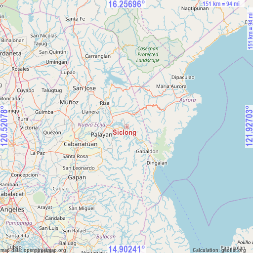
Siclong GPS coordinates[2]
15° 34' 50.88" North, 121° 13' 26.04" East
| Map corner | latitude | longitude |
|---|---|---|
| Upper-left | 16.25696°, | 120.52078° |
| Center: | 15.5808°, | 121.2239° |
| Lower-right: | 14.90241°, | 121.92703° |
| Map W x H: | 150.6×150.6 km | = 93.6×93.6mi |
| max Lat: | 20.78733° ⇑17.6% North |
| Siclong: | 15.5808° |
| min Lat: | ⇓82.4% South 4.65442° |
| min Long | Siclong | max Long |
| 117.04868° | 121.2239° | 126.58417° |
| W 28.8%⇐ | ⇒71.2% E |
Elevation
Elevation of Siclong is 102 m = 335 ft, and this is 14.1 m = 46 ft above average elevation for this country.
| Max E: |
2262 m = 7421 ft | 18.6% |
| Siclong | 102 m 335 ft | |
| Avg. | 87.9 m = 288 ft | |
Min E: |
-2 m = -7 ft | 81.4% |
See also: Philippines elevation on elevation.city.
Geographical zone
Siclong is located in North Torrid zone (between Equator and Tropic of Cancer). Distance of this Northern Tropic circle is 873.5 km =542.8 mi to North.| Distance of | km | miles | from Siclong |
|---|---|---|---|
| North Pole | 8274.6 | 5141.6 | to North |
| Arctic Circle | 5668.8 | 3522.4 | to North |
| Tropic Cancer | 873.5 | 542.8 | to North |
| Equator | 1732.4 | 1076.5 | to South |


Nearby cities:
15 places around Siclong: (largest is in red/bold)
• Agbannawag
18.6 km =11.6 mi,  306°
306°
• Antipolo
5.5 km =3.4 mi,  318°
318°
• Bagong-Sikat
14.3 km =8.9 mi,  141°
141°
• Bongabon
10.2 km =6.3 mi,  303°
303°
• General Luna
17.3 km =10.7 mi,  343°
343°
• General Mamerto Natividad
18.6 km =11.6 mi,  277°
277°
• Laur
4.4 km =2.7 mi, 278°
• Ligaya
10.5 km =6.5 mi, 139°
• Macapsing
14.6 km =9.1 mi, 317°
• Macatbong
17.7 km =11 mi,  241°
241°
• Paco Roman
17 km =10.6 mi, 301°
• Palayan City
15.5 km =9.6 mi,  253°
253°
• Piñahan
18.1 km =11.2 mi,  286°
286°
• Sagana
7.8 km =4.8 mi,  260°
260°
• Sapang Buho
10.7 km =6.6 mi, 275°
Sources, notices
• [Note1] Compared only with cities in Philippines existing in our database
• [Src1] Map data: © OpenStreetMap contributors (CC-BY-SA)
• [Src2] Other city data from geonames.org with taken over terms of usage.
• [Src3] Geographical zone / Annual Mean Temperature by Robert A. Rohde @ Wikipedia
