De la Paz geodata
De la Paz (Western Visayas) is a populated place; located in Philippines in Asia/Manila (GMT+8) time zone. With population of 2,117 people, there are 4047 cities with bigger population in this country. Compared to other cities in Philippines, 56.1% of cities are located further ↑North; 50.4% of cities are located further →East and 53.5% of cities have lower elevation than De la Paz. Note1


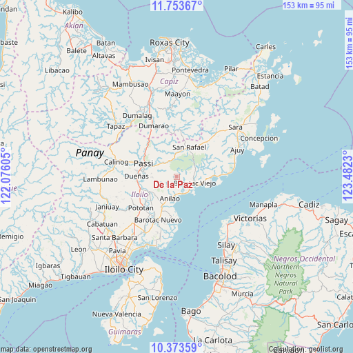
De la Paz GPS coordinates[2]
11° 3' 51.984" North, 122° 46' 45.012" East
| Map corner | latitude | longitude |
|---|---|---|
| Upper-left | 11.75367°, | 122.07605° |
| Center: | 11.06444°, | 122.77917° |
| Lower-right: | 10.37359°, | 123.4823° |
| Map W x H: | 153.5×153.5 km | = 95.4×95.4mi |
| max Lat: | 20.78733° ⇑56.1% North |
| De la Paz: | 11.06444° |
| min Lat: | ⇓43.9% South 4.65442° |
| min Long | De la Paz | max Long |
| 117.04868° | 122.77917° | 126.58417° |
| W 49.6%⇐ | ⇒50.4% E |
Elevation
Elevation of De la Paz is 26 m = 85 ft, and this is 61.9 m = 203 ft below average elevation for this country.
| Max E: |
2262 m = 7421 ft | 46.5% |
| Avg. | 87.9 m = 288 ft | |
| De la Paz | 26 m = 85 ft | |
Min E: |
-2 m = -7 ft | 53.5% |
See also: Philippines elevation on elevation.city.
Geographical zone
De la Paz is located in North Torrid zone (between Equator and Tropic of Cancer). Distance of Equator is 1230.3 km =764.5 mi to South.| Distance of | km | miles | from De la Paz |
|---|---|---|---|
| North Pole | 8776.8 | 5453.6 | to North |
| Arctic Circle | 6170.9 | 3834.4 | to North |
| Tropic Cancer | 1375.7 | 854.8 | to North |
| Equator | 1230.3 | 764.5 | to South |


Nearby cities:
15 places around De la Paz: (largest is in red/bold)
• Abaca
10.4 km =6.5 mi,  318°
318°
• Alimono
15.3 km =9.5 mi,  331°
331°
• Anilao
10.1 km =6.3 mi,  196°
196°
• Banate
8.1 km =5 mi,  148°
148°
• Barotac Viejo
8.4 km =5.2 mi,  107°
107°
• Carmelo
6.7 km =4.2 mi,  142°
142°
• Dingle
13.8 km =8.6 mi,  238°
238°
• Jaguimitan
10.4 km =6.5 mi, 324°
• Libertad
3.4 km =2.1 mi, 198°
• Mapili
6.5 km =4 mi, 318°
• San Enrique
13.5 km =8.4 mi,  273°
273°
• San Rafael
13.7 km =8.5 mi,  22°
22°
• San Salvador
9.2 km =5.7 mi, 138°
• Santiago
14.5 km =9 mi,  92°
92°
• Talokgañgan
9.6 km =6 mi,  131°
131°
Sources, notices
• [Note1] Compared only with cities in Philippines existing in our database
• [Src1] Map data: © OpenStreetMap contributors (CC-BY-SA)
• [Src2] Other city data from geonames.org with taken over terms of usage.
• [Src3] Geographical zone / Annual Mean Temperature by Robert A. Rohde @ Wikipedia
