Lambunao geodata
Lambunao (Western Visayas) is a seat of a third-order administrative division; located in Philippines in Asia/Manila (GMT+8) time zone. With population of 5,500 people, there are 1158 cities with bigger population in this country. Compared to other cities in Philippines, 56.3% of cities are located further ↑North; 55.2% of cities are located further →East and 87.8% of cities have lower elevation than Lambunao. Note1


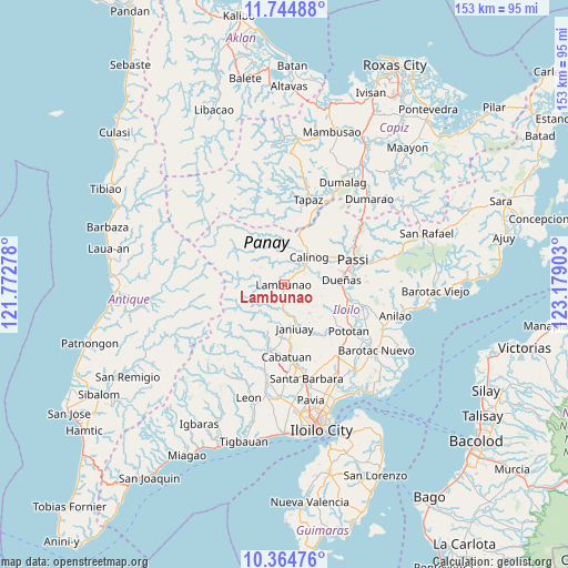
Lambunao GPS coordinates[2]
11° 3' 20.268" North, 122° 28' 33.24" East
| Map corner | latitude | longitude |
|---|---|---|
| Upper-left | 11.74488°, | 121.77278° |
| Center: | 11.05563°, | 122.4759° |
| Lower-right: | 10.36476°, | 123.17903° |
| Map W x H: | 153.5×153.5 km | = 95.4×95.4mi |
| max Lat: | 20.78733° ⇑56.3% North |
| Lambunao: | 11.05563° |
| min Lat: | ⇓43.7% South 4.65442° |
| min Long | Lambunao | max Long |
| 117.04868° | 122.4759° | 126.58417° |
| W 44.8%⇐ | ⇒55.2% E |
Elevation
Elevation of Lambunao is 177 m = 581 ft, and this is 89.1 m = 292 ft above average elevation for this country.
| Max E: |
2262 m = 7421 ft | 12.2% |
| Lambunao | 177 m 581 ft | |
| Avg. | 87.9 m = 288 ft | |
Min E: |
-2 m = -7 ft | 87.8% |
See also: Philippines elevation on elevation.city.
Geographical zone
Lambunao is located in North Torrid zone (between Equator and Tropic of Cancer). Distance of Equator is 1229.3 km =763.9 mi to South.| Distance of | km | miles | from Lambunao |
|---|---|---|---|
| North Pole | 8777.8 | 5454.3 | to North |
| Arctic Circle | 6171.9 | 3835 | to North |
| Tropic Cancer | 1376.6 | 855.4 | to North |
| Equator | 1229.3 | 763.9 | to South |


Nearby cities:
15 places around Lambunao: (largest is in red/bold)
• Alibunan
10.3 km =6.4 mi,  349°
349°
• Badiangan
6.2 km =3.9 mi,  154°
154°
• Badlan
10.7 km =6.6 mi,  26°
26°
• Binabaan
6.5 km =4 mi,  128°
128°
• Calinog
12 km =7.5 mi,  55°
55°
• Dueñas
15.3 km =9.5 mi,  85°
85°
• Gines-Patay
13.5 km =8.4 mi,  171°
171°
• Janiuay
12.3 km =7.6 mi,  164°
164°
• Jayubó
10.1 km =6.3 mi,  266°
266°
• Maasin
18.7 km =11.6 mi,  193°
193°
• Maribong
8 km =5 mi,  51°
51°
• Mina
17.5 km =10.9 mi,  142°
142°
• Passi
19 km =11.8 mi,  72°
72°
• Ponong
16.7 km =10.4 mi,  79°
79°
• Quinagaringan
14.3 km =8.9 mi, 58°
Sources, notices
• [Note1] Compared only with cities in Philippines existing in our database
• [Src1] Map data: © OpenStreetMap contributors (CC-BY-SA)
• [Src2] Other city data from geonames.org with taken over terms of usage.
• [Src3] Geographical zone / Annual Mean Temperature by Robert A. Rohde @ Wikipedia
