Lagayan geodata
Lagayan (Cordillera) is a seat of a third-order administrative division; located in Philippines in Asia/Manila (GMT+8) time zone. In our database, there are 4166 cities with bigger population. Compared to other cities in Philippines, 97.4% of cities are located further ↓South; 84.8% of cities are located further →East and 82.5% of cities have lower elevation than Lagayan. Note1


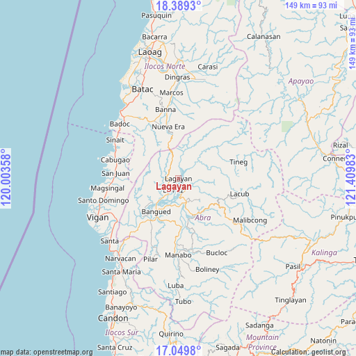
Lagayan GPS coordinates[2]
17° 43' 14.88" North, 120° 42' 24.12" East
| Map corner | latitude | longitude |
|---|---|---|
| Upper-left | 18.3893°, | 120.00358° |
| Center: | 17.7208°, | 120.7067° |
| Lower-right: | 17.0498°, | 121.40983° |
| Map W x H: | 148.9×148.9 km | = 92.5×92.5mi |
| max Lat: | 20.78733° ⇑2.6% North |
| Lagayan: | 17.7208° |
| min Lat: | ⇓97.4% South 4.65442° |
| min Long | Lagayan | max Long |
| 117.04868° | 120.7067° | 126.58417° |
| W 15.2%⇐ | ⇒84.8% E |
Elevation
Elevation of Lagayan is 111 m = 364 ft, and this is 23.1 m = 76 ft above average elevation for this country.
| Max E: |
2262 m = 7421 ft | 17.5% |
| Lagayan | 111 m 364 ft | |
| Avg. | 87.9 m = 288 ft | |
Min E: |
-2 m = -7 ft | 82.5% |
See also: Philippines elevation on elevation.city.
Geographical zone
Lagayan is located in North Torrid zone (between Equator and Tropic of Cancer). Distance of this Northern Tropic circle is 635.6 km =394.9 mi to North.| Distance of | km | miles | from Lagayan |
|---|---|---|---|
| North Pole | 8036.7 | 4993.8 | to North |
| Arctic Circle | 5430.8 | 3374.5 | to North |
| Tropic Cancer | 635.6 | 394.9 | to North |
| Equator | 1970.4 | 1224.3 | to South |


Nearby cities:
15 places around Lagayan: (largest is in red/bold)
• Angad
17.4 km =10.8 mi,  209°
209°
• Bangued
14.5 km =9 mi, 210°
• Bucay
20.1 km =12.5 mi,  176°
176°
• Calaba
14.9 km =9.3 mi,  219°
219°
• Danglas
5.8 km =3.6 mi,  247°
247°
• Dolores
8.1 km =5 mi, 178°
• La Paz
5.6 km =3.5 mi,  202°
202°
• Lagangilang
12.4 km =7.7 mi,  165°
165°
• Langiden
22 km =13.7 mi, 223°
• Licuan
24.5 km =15.2 mi,  120°
120°
• Nueva Era
22.2 km =13.8 mi,  348°
348°
• Peñarrubia
18.3 km =11.4 mi, 198°
• Pidigan
20.8 km =12.9 mi, 216°
• San Juan
5 km =3.1 mi,  147°
147°
• Tayum
12.8 km =8 mi, 205°
Sources, notices
• [Note1] Compared only with cities in Philippines existing in our database
• [Src1] Map data: © OpenStreetMap contributors (CC-BY-SA)
• [Src2] Other city data from geonames.org with taken over terms of usage.
• [Src3] Geographical zone / Annual Mean Temperature by Robert A. Rohde @ Wikipedia
