Licuan geodata
Licuan (Cordillera) is a seat of a third-order administrative division; located in Philippines in Asia/Manila (GMT+8) time zone. In our database, there are 4166 cities with bigger population. Compared to other cities in Philippines, 96.6% of cities are located further ↓South; 79.2% of cities are located further →East and 94.1% of cities have lower elevation than Licuan. Note1
Administrative division(s):
- Level 1: Cordillera
- Level 2: Province of Abra
- Level 3: Licuan-Baay (Licuan)


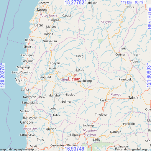
Licuan GPS coordinates[2]
17° 36' 32.04" North, 120° 54' 21.24" East
| Map corner | latitude | longitude |
|---|---|---|
| Upper-left | 18.27782°, | 120.20278° |
| Center: | 17.6089°, | 120.9059° |
| Lower-right: | 16.93749°, | 121.60903° |
| Map W x H: | 149×149 km | = 92.6×92.6mi |
| max Lat: | 20.78733° ⇑3.4% North |
| Licuan: | 17.6089° |
| min Lat: | ⇓96.6% South 4.65442° |
| min Long | Licuan | max Long |
| 117.04868° | 120.9059° | 126.58417° |
| W 20.8%⇐ | ⇒79.2% E |
Elevation
Elevation of Licuan is 377 m = 1237 ft, and this is 289.1 m = 948 ft above average elevation for this country.
| Max E: |
2262 m = 7421 ft | 5.9% |
| Licuan | 377 m 1237 ft | |
| Avg. | 87.9 m = 288 ft | |
Min E: |
-2 m = -7 ft | 94.1% |
See also: Philippines elevation on elevation.city.
Geographical zone
Licuan is located in North Torrid zone (between Equator and Tropic of Cancer). Distance of this Northern Tropic circle is 648 km =402.6 mi to North.| Distance of | km | miles | from Licuan |
|---|---|---|---|
| North Pole | 8049.1 | 5001.5 | to North |
| Arctic Circle | 5443.2 | 3382.2 | to North |
| Tropic Cancer | 648 | 402.6 | to North |
| Equator | 1957.9 | 1216.6 | to South |


Nearby cities:
15 places around Licuan: (largest is in red/bold)
• Bangued
28.4 km =17.6 mi,  269°
269°
• Bantay
24.7 km =15.3 mi,  219°
219°
• Boliney
26 km =16.2 mi,  210°
210°
• Bucay
21.2 km =13.2 mi,  248°
248°
• Bucloc
19.3 km =12 mi,  194°
194°
• Daguioman
17.6 km =10.9 mi,  176°
176°
• Danglas
28.4 km =17.6 mi,  291°
291°
• Dolores
21.3 km =13.2 mi,  281°
281°
• La Paz
24.4 km =15.2 mi, 287°
• Lagangilang
18 km =11.2 mi, 271°
• Lagayan
24.5 km =15.2 mi,  300°
300°
• Manabo
28.9 km =18 mi,  227°
227°
• Peñarrubia
27.4 km =17 mi,  259°
259°
• San Juan
20.1 km =12.5 mi, 294°
• Tayum
26.7 km =16.6 mi, 271°
Sources, notices
• [Note1] Compared only with cities in Philippines existing in our database
• [Src1] Map data: © OpenStreetMap contributors (CC-BY-SA)
• [Src2] Other city data from geonames.org with taken over terms of usage.
• [Src3] Geographical zone / Annual Mean Temperature by Robert A. Rohde @ Wikipedia
