Dolores geodata
Dolores (Cordillera) is a seat of a third-order administrative division; located in Philippines in Asia/Manila (GMT+8) time zone. With population of 2,378 people, there are 3502 cities with bigger population in this country. Compared to other cities in Philippines, 97% of cities are located further ↓South; 84.7% of cities are located further →East and 77.7% of cities have lower elevation than Dolores. Note1


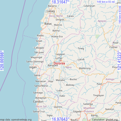
Dolores GPS coordinates[2]
17° 38' 51.72" North, 120° 42' 32.76" East
| Map corner | latitude | longitude |
|---|---|---|
| Upper-left | 18.31647°, | 120.00598° |
| Center: | 17.6477°, | 120.7091° |
| Lower-right: | 16.97643°, | 121.41223° |
| Map W x H: | 149×149 km | = 92.6×92.6mi |
| max Lat: | 20.78733° ⇑3% North |
| Dolores: | 17.6477° |
| min Lat: | ⇓97% South 4.65442° |
| min Long | Dolores | max Long |
| 117.04868° | 120.7091° | 126.58417° |
| W 15.3%⇐ | ⇒84.7% E |
Elevation
Elevation of Dolores is 79 m = 259 ft, and this is 8.9 m = 29 ft below average elevation for this country.
| Max E: |
2262 m = 7421 ft | 22.3% |
| Avg. | 87.9 m = 288 ft | |
| Dolores | 79 m = 259 ft | |
Min E: |
-2 m = -7 ft | 77.7% |
See also: Philippines elevation on elevation.city.
Geographical zone
Dolores is located in North Torrid zone (between Equator and Tropic of Cancer). Distance of this Northern Tropic circle is 643.7 km =400 mi to North.| Distance of | km | miles | from Dolores |
|---|---|---|---|
| North Pole | 8044.8 | 4998.8 | to North |
| Arctic Circle | 5438.9 | 3379.6 | to North |
| Tropic Cancer | 643.7 | 400 | to North |
| Equator | 1962.2 | 1219.3 | to South |


Nearby cities:
15 places around Dolores: (largest is in red/bold)
• Angad
11.3 km =7 mi,  231°
231°
• Bangued
8.7 km =5.4 mi,  239°
239°
• Bucay
12 km =7.5 mi,  175°
175°
• Calaba
10.4 km =6.5 mi,  251°
251°
• Danglas
8.2 km =5.1 mi,  316°
316°
• La Paz
3.8 km =2.4 mi, 321°
• Lagangilang
4.8 km =3 mi,  144°
144°
• Lagayan
8.1 km =5 mi,  358°
358°
• Langiden
17.3 km =10.7 mi, 242°
• Licuan
21.3 km =13.2 mi,  101°
101°
• Peñarrubia
11 km =6.8 mi,  213°
213°
• Pidigan
15.3 km =9.5 mi, 235°
• San Isidro
23.2 km =14.4 mi, 208°
• San Juan
4.6 km =2.9 mi,  32°
32°
• Tayum
6.7 km =4.2 mi, 239°
Sources, notices
• [Note1] Compared only with cities in Philippines existing in our database
• [Src1] Map data: © OpenStreetMap contributors (CC-BY-SA)
• [Src2] Other city data from geonames.org with taken over terms of usage.
• [Src3] Geographical zone / Annual Mean Temperature by Robert A. Rohde @ Wikipedia
