Talaga geodata
Talaga (Calabarzon) is a populated place; located in Philippines in Asia/Manila (GMT+8) time zone. With population of 3,231 people, there are 2275 cities with bigger population in this country. Compared to other cities in Philippines, 64.8% of cities are located further ↓South; 78.3% of cities are located further →East and 80.7% of cities have higher elevation than Talaga. Note1


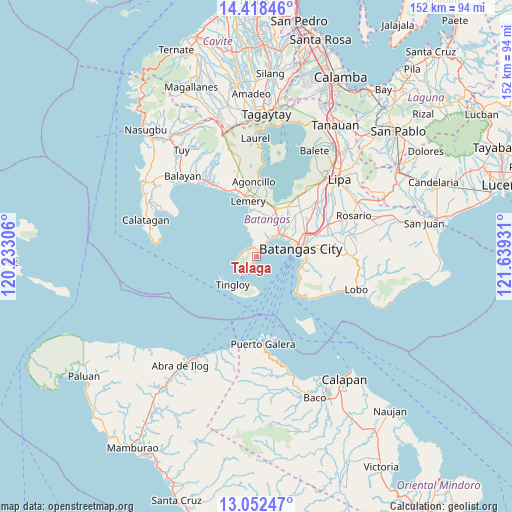
Talaga GPS coordinates[2]
13° 44' 11.256" North, 120° 56' 10.248" East
| Map corner | latitude | longitude |
|---|---|---|
| Upper-left | 14.41846°, | 120.23306° |
| Center: | 13.73646°, | 120.93618° |
| Lower-right: | 13.05247°, | 121.63931° |
| Map W x H: | 151.9×151.9 km | = 94.4×94.4mi |
| max Lat: | 20.78733° ⇑35.2% North |
| Talaga: | 13.73646° |
| min Lat: | ⇓64.8% South 4.65442° |
| min Long | Talaga | max Long |
| 117.04868° | 120.93618° | 126.58417° |
| W 21.7%⇐ | ⇒78.3% E |
Elevation
Elevation of Talaga is 9 m = 30 ft, and this is 78.9 m = 259 ft below average elevation for this country.
| Max E: |
2262 m = 7421 ft | 80.7% |
| Avg. | 87.9 m = 288 ft | |
| Talaga | 9 m = 30 ft | |
Min E: |
-2 m = -7 ft | 19.3% |
See also: Philippines elevation on elevation.city.
Geographical zone
Talaga is located in North Torrid zone (between Equator and Tropic of Cancer). Distance of this Northern Tropic circle is 1078.6 km =670.2 mi to North.| Distance of | km | miles | from Talaga |
|---|---|---|---|
| North Pole | 8479.7 | 5269 | to North |
| Arctic Circle | 5873.8 | 3649.8 | to North |
| Tropic Cancer | 1078.6 | 670.2 | to North |
| Equator | 1527.4 | 949.1 | to South |


Nearby cities:
15 places around Talaga: (largest is in red/bold)
• Bagalangit
6.3 km =3.9 mi,  242°
242°
• Batangas
13.4 km =8.3 mi,  80°
80°
• Bauan
9.9 km =6.2 mi,  51°
51°
• Bolo
7.7 km =4.8 mi,  39°
39°
• Calumpang
12.5 km =7.8 mi,  19°
19°
• Inicbulan
10.6 km =6.6 mi,  28°
28°
• Mabini
1.9 km =1.2 mi,  14°
14°
• San Jose
12.9 km =8 mi, 6°
• San Luis
13.3 km =8.3 mi,  350°
350°
• San Pascual
12.4 km =7.7 mi, 48°
• Santa Rita Aplaya
11.4 km =7.1 mi,  69°
69°
• Sinala
8.7 km =5.4 mi, 28°
• Solo
4 km =2.5 mi,  287°
287°
• Tingloy
11 km =6.8 mi,  219°
219°
• Wawa
12.6 km =7.8 mi,  88°
88°
Sources, notices
• [Note1] Compared only with cities in Philippines existing in our database
• [Src1] Map data: © OpenStreetMap contributors (CC-BY-SA)
• [Src2] Other city data from geonames.org with taken over terms of usage.
• [Src3] Geographical zone / Annual Mean Temperature by Robert A. Rohde @ Wikipedia
