Gumalang geodata
Gumalang (Davao) is a populated place; located in Philippines in Asia/Manila (GMT+8) time zone. With population of 4,313 people, there are 1577 cities with bigger population in this country. Compared to other cities in Philippines, 89.4% of cities are located further ↑North; 92.1% of cities are located further ←West and 94.2% of cities have lower elevation than Gumalang. Note1


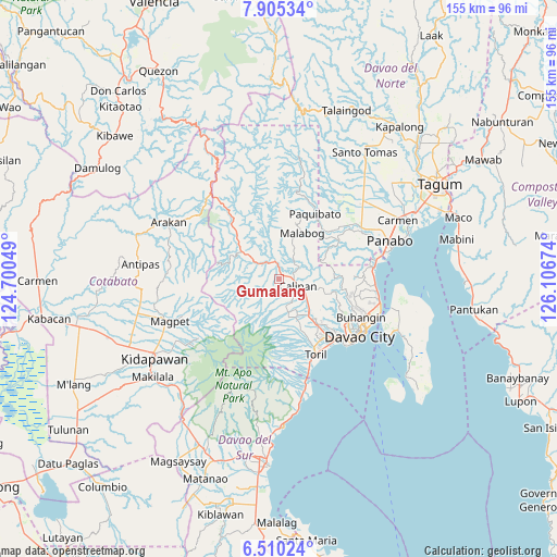
Gumalang GPS coordinates[2]
7° 12' 29.988" North, 125° 24' 12.996" East
| Map corner | latitude | longitude |
|---|---|---|
| Upper-left | 7.90534°, | 124.70049° |
| Center: | 7.20833°, | 125.40361° |
| Lower-right: | 6.51024°, | 126.10674° |
| Map W x H: | 155.1×155.1 km | = 96.4×96.4mi |
| max Lat: | 20.78733° ⇑89.4% North |
| Gumalang: | 7.20833° |
| min Lat: | ⇓10.6% South 4.65442° |
| min Long | Gumalang | max Long |
| 117.04868° | 125.40361° | 126.58417° |
| W 92.1%⇐ | ⇒7.9% E |
Elevation
Elevation of Gumalang is 382 m = 1253 ft, and this is 294.1 m = 965 ft above average elevation for this country.
| Max E: |
2262 m = 7421 ft | 5.8% |
| Gumalang | 382 m 1253 ft | |
| Avg. | 87.9 m = 288 ft | |
Min E: |
-2 m = -7 ft | 94.2% |
See also: Philippines elevation on elevation.city.
Geographical zone
Gumalang is located in North Torrid zone (between Equator and Tropic of Cancer). Distance of Equator is 801.5 km =498 mi to South.| Distance of | km | miles | from Gumalang |
|---|---|---|---|
| North Pole | 9205.6 | 5720.1 | to North |
| Arctic Circle | 6599.7 | 4100.9 | to North |
| Tropic Cancer | 1804.4 | 1121.2 | to North |
| Equator | 801.5 | 498 | to South |


Nearby cities:
15 places around Gumalang: (largest is in red/bold)
• Bato
19.9 km =12.4 mi,  157°
157°
• Biao
13.9 km =8.6 mi,  111°
111°
• Dacudao
7.5 km =4.7 mi,  84°
84°
• Lacson
4.3 km =2.7 mi, 84°
• Mabuhay
21.1 km =13.1 mi,  48°
48°
• Malagos
3.3 km =2.1 mi,  141°
141°
• Sirib
8.3 km =5.2 mi,  177°
177°
• Tagakpan
11 km =6.8 mi,  165°
165°
• Tamayong
8.8 km =5.5 mi,  197°
197°
• Tamugan
3.9 km =2.4 mi,  309°
309°
• Tawan tawan
5.5 km =3.4 mi,  217°
217°
• Tuli
3.1 km =1.9 mi,  27°
27°
• Ula
12.9 km =8 mi,  130°
130°
• Wañgan
7.1 km =4.4 mi, 139°
• Wines
2.3 km =1.4 mi, 224°
Sources, notices
• [Note1] Compared only with cities in Philippines existing in our database
• [Src1] Map data: © OpenStreetMap contributors (CC-BY-SA)
• [Src2] Other city data from geonames.org with taken over terms of usage.
• [Src3] Geographical zone / Annual Mean Temperature by Robert A. Rohde @ Wikipedia
