Wines geodata
Wines (Davao) is a populated place; located in Philippines in Asia/Manila (GMT+8) time zone. With population of 2,907 people, there are 2631 cities with bigger population in this country. Compared to other cities in Philippines, 89.5% of cities are located further ↑North; 92% of cities are located further ←West and 95.5% of cities have lower elevation than Wines. Note1


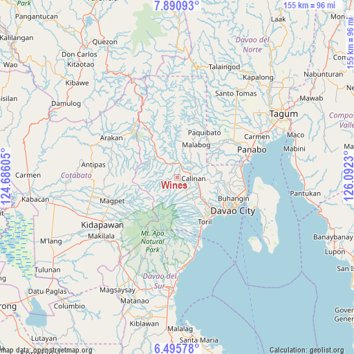
Wines GPS coordinates[2]
7° 11' 38.004" North, 125° 23' 21.012" East
| Map corner | latitude | longitude |
|---|---|---|
| Upper-left | 7.89093°, | 124.68605° |
| Center: | 7.19389°, | 125.38917° |
| Lower-right: | 6.49578°, | 126.0923° |
| Map W x H: | 155.1×155.1 km | = 96.4×96.4mi |
| max Lat: | 20.78733° ⇑89.5% North |
| Wines: | 7.19389° |
| min Lat: | ⇓10.5% South 4.65442° |
| min Long | Wines | max Long |
| 117.04868° | 125.38917° | 126.58417° |
| W 92%⇐ | ⇒8% E |
Elevation
Elevation of Wines is 454 m = 1490 ft, and this is 366.1 m = 1201 ft above average elevation for this country.
| Max E: |
2262 m = 7421 ft | 4.5% |
| Wines | 454 m 1490 ft | |
| Avg. | 87.9 m = 288 ft | |
Min E: |
-2 m = -7 ft | 95.5% |
See also: Philippines elevation on elevation.city.
Geographical zone
Wines is located in North Torrid zone (between Equator and Tropic of Cancer). Distance of Equator is 799.9 km =497 mi to South.| Distance of | km | miles | from Wines |
|---|---|---|---|
| North Pole | 9207.2 | 5721.1 | to North |
| Arctic Circle | 6601.3 | 4101.9 | to North |
| Tropic Cancer | 1806 | 1122.2 | to North |
| Equator | 799.9 | 497 | to South |


Nearby cities:
15 places around Wines: (largest is in red/bold)
• Bato
19.2 km =11.9 mi,  151°
151°
• Biao
14.9 km =9.3 mi,  103°
103°
• Dacudao
9.4 km =5.8 mi,  75°
75°
• Gumalang
2.3 km =1.4 mi,  44°
44°
• Lacson
6.2 km =3.9 mi,  71°
71°
• Mabuhay
23.3 km =14.5 mi,  48°
48°
• Malagos
3.8 km =2.4 mi,  105°
105°
• Sirib
7 km =4.3 mi,  163°
163°
• Tagakpan
10 km =6.2 mi, 153°
• Tamayong
6.8 km =4.2 mi,  188°
188°
• Tamugan
4.3 km =2.7 mi,  341°
341°
• Tawan tawan
3.3 km =2.1 mi,  213°
213°
• Tuli
5.3 km =3.3 mi,  34°
34°
• Ula
13.3 km =8.3 mi,  121°
121°
• Wañgan
7.3 km =4.5 mi, 121°
Sources, notices
• [Note1] Compared only with cities in Philippines existing in our database
• [Src1] Map data: © OpenStreetMap contributors (CC-BY-SA)
• [Src2] Other city data from geonames.org with taken over terms of usage.
• [Src3] Geographical zone / Annual Mean Temperature by Robert A. Rohde @ Wikipedia
