Cuambog geodata
Cuambog (Davao) is a populated place; located in Philippines in Asia/Manila (GMT+8) time zone. With population of 6,383 people, there are 979 cities with bigger population in this country. Compared to other cities in Philippines, 88.5% of cities are located further ↑North; 96.8% of cities are located further ←West and 70.2% of cities have higher elevation than Cuambog. Note1


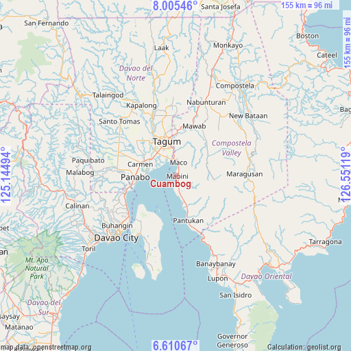
Cuambog GPS coordinates[2]
7° 18' 30.996" North, 125° 50' 53.016" East
| Map corner | latitude | longitude |
|---|---|---|
| Upper-left | 8.00546°, | 125.14494° |
| Center: | 7.30861°, | 125.84806° |
| Lower-right: | 6.61067°, | 126.55119° |
| Map W x H: | 155.1×155.1 km | = 96.4×96.4mi |
| max Lat: | 20.78733° ⇑88.5% North |
| Cuambog: | 7.30861° |
| min Lat: | ⇓11.5% South 4.65442° |
| min Long | Cuambog | max Long |
| 117.04868° | 125.84806° | 126.58417° |
| W 96.8%⇐ | ⇒3.2% E |
Elevation
Elevation of Cuambog is 12 m = 39 ft, and this is 75.9 m = 249 ft below average elevation for this country.
| Max E: |
2262 m = 7421 ft | 70.2% |
| Avg. | 87.9 m = 288 ft | |
| Cuambog | 12 m = 39 ft | |
Min E: |
-2 m = -7 ft | 29.8% |
See also: Philippines elevation on elevation.city.
Geographical zone
Cuambog is located in North Torrid zone (between Equator and Tropic of Cancer). Distance of Equator is 812.6 km =504.9 mi to South.| Distance of | km | miles | from Cuambog |
|---|---|---|---|
| North Pole | 9194.4 | 5713.1 | to North |
| Arctic Circle | 6588.5 | 4093.9 | to North |
| Tropic Cancer | 1793.3 | 1114.3 | to North |
| Equator | 812.6 | 504.9 | to South |


Nearby cities:
15 places around Cuambog: (largest is in red/bold)
• Bincoñgan
12.6 km =7.8 mi,  300°
300°
• Bungabon
10 km =6.2 mi,  163°
163°
• Corocotan
13.1 km =8.1 mi,  320°
320°
• Dumlan
13.7 km =8.5 mi,  15°
15°
• Hiju, Maco
8.8 km =5.5 mi,  345°
345°
• La Paz
12.7 km =7.9 mi,  273°
273°
• Libuganon
8.9 km =5.5 mi, 300°
• Mabini
0.6 km =0.4 mi,  59°
59°
• Maco
6 km =3.7 mi,  7°
7°
• Pandasan
2.8 km =1.7 mi,  167°
167°
• Santo Niño
15.9 km =9.9 mi,  277°
277°
• Tagdanua
12.3 km =7.6 mi, 161°
• Tagnanan
2.9 km =1.8 mi,  193°
193°
• Tibagon
8.6 km =5.3 mi, 169°
• Tuganay
15.3 km =9.5 mi, 295°
Sources, notices
• [Note1] Compared only with cities in Philippines existing in our database
• [Src1] Map data: © OpenStreetMap contributors (CC-BY-SA)
• [Src2] Other city data from geonames.org with taken over terms of usage.
• [Src3] Geographical zone / Annual Mean Temperature by Robert A. Rohde @ Wikipedia
