Dapdap geodata
Dapdap (Eastern Visayas) is a populated place; located in Philippines in Asia/Manila (GMT+8) time zone. With population of 2,223 people, there are 3841 cities with bigger population in this country. Compared to other cities in Philippines, 52% of cities are located further ↓South; 93.4% of cities are located further ←West and 89.7% of cities have higher elevation than Dapdap. Note1
Administrative division(s):
- Level 1: Eastern Visayas
- Level 2: Province of Eastern Samar
- Level 3: Dolores


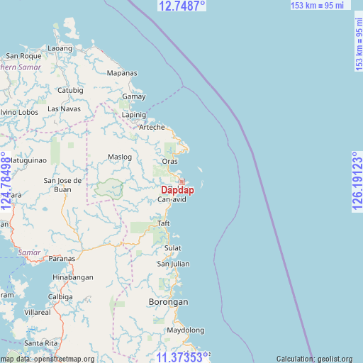
Dapdap GPS coordinates[2]
12° 3' 43.2" North, 125° 29' 17.16" East
| Map corner | latitude | longitude |
|---|---|---|
| Upper-left | 12.7487°, | 124.78498° |
| Center: | 12.062°, | 125.4881° |
| Lower-right: | 11.37353°, | 126.19123° |
| Map W x H: | 152.9×152.9 km | = 95×95mi |
| max Lat: | 20.78733° ⇑48% North |
| Dapdap: | 12.062° |
| min Lat: | ⇓52% South 4.65442° |
| min Long | Dapdap | max Long |
| 117.04868° | 125.4881° | 126.58417° |
| W 93.4%⇐ | ⇒6.6% E |
Elevation
Elevation of Dapdap is 7 m = 23 ft, and this is 80.9 m = 265 ft below average elevation for this country.
| Max E: |
2262 m = 7421 ft | 89.7% |
| Avg. | 87.9 m = 288 ft | |
| Dapdap | 7 m = 23 ft | |
Min E: |
-2 m = -7 ft | 10.3% |
See also: Philippines elevation on elevation.city.
Geographical zone
Dapdap is located in North Torrid zone (between Equator and Tropic of Cancer). Distance of this Northern Tropic circle is 1264.8 km =785.9 mi to North.| Distance of | km | miles | from Dapdap |
|---|---|---|---|
| North Pole | 8665.9 | 5384.7 | to North |
| Arctic Circle | 6060 | 3765.5 | to North |
| Tropic Cancer | 1264.8 | 785.9 | to North |
| Equator | 1341.2 | 833.4 | to South |


Nearby cities:
15 places around Dapdap: (largest is in red/bold)
• Alugan
17.5 km =10.9 mi,  357°
357°
• Arteche
24.3 km =15.1 mi,  338°
338°
• Can-Avid
8.6 km =5.3 mi,  210°
210°
• Dao
6.9 km =4.3 mi,  307°
307°
• Dolores
2.8 km =1.7 mi,  192°
192°
• Lapinig
34.6 km =21.5 mi,  324°
324°
• Mantang
22.3 km =13.9 mi,  196°
196°
• Maslog
29.4 km =18.3 mi,  289°
289°
• Nena
33.8 km =21 mi, 193°
• Oras
10.2 km =6.3 mi,  328°
328°
• San Eduardo
12.5 km =7.8 mi, 340°
• San Julian
34.5 km =21.4 mi, 185°
• San Policarpo
13.2 km =8.2 mi,  9°
9°
• Sulat
28.2 km =17.5 mi, 187°
• Taft
19.4 km =12.1 mi, 202°
Sources, notices
• [Note1] Compared only with cities in Philippines existing in our database
• [Src1] Map data: © OpenStreetMap contributors (CC-BY-SA)
• [Src2] Other city data from geonames.org with taken over terms of usage.
• [Src3] Geographical zone / Annual Mean Temperature by Robert A. Rohde @ Wikipedia
