Nena geodata
Nena (Eastern Visayas) is a populated place; located in Philippines in Asia/Manila (GMT+8) time zone. With population of 2,276 people, there are 3730 cities with bigger population in this country. Compared to other cities in Philippines, 50.8% of cities are located further ↓South; 92.3% of cities are located further ←West and 95.5% of cities have higher elevation than Nena. Note1
Administrative division(s):
- Level 1: Eastern Visayas
- Level 2: Province of Eastern Samar
- Level 3: San Julian


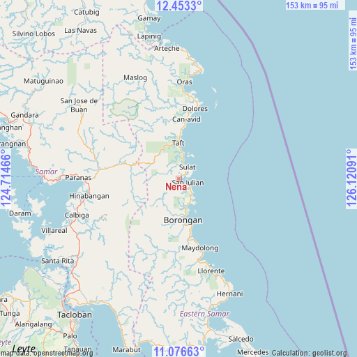
Nena GPS coordinates[2]
11° 45' 56.988" North, 125° 25' 4.008" East
| Map corner | latitude | longitude |
|---|---|---|
| Upper-left | 12.4533°, | 124.71466° |
| Center: | 11.76583°, | 125.41778° |
| Lower-right: | 11.07663°, | 126.12091° |
| Map W x H: | 153.1×153.1 km | = 95.1×95.1mi |
| max Lat: | 20.78733° ⇑49.2% North |
| Nena: | 11.76583° |
| min Lat: | ⇓50.8% South 4.65442° |
| min Long | Nena | max Long |
| 117.04868° | 125.41778° | 126.58417° |
| W 92.3%⇐ | ⇒7.7% E |
Elevation
Elevation of Nena is 5 m = 16 ft, and this is 82.9 m = 272 ft below average elevation for this country.
| Max E: |
2262 m = 7421 ft | 95.5% |
| Avg. | 87.9 m = 288 ft | |
| Nena | 5 m = 16 ft | |
Min E: |
-2 m = -7 ft | 4.5% |
See also: Philippines elevation on elevation.city.
Geographical zone
Nena is located in North Torrid zone (between Equator and Tropic of Cancer). Distance of this Northern Tropic circle is 1297.7 km =806.4 mi to North.| Distance of | km | miles | from Nena |
|---|---|---|---|
| North Pole | 8698.8 | 5405.2 | to North |
| Arctic Circle | 6092.9 | 3786 | to North |
| Tropic Cancer | 1297.7 | 806.4 | to North |
| Equator | 1308.2 | 812.9 | to South |


Nearby cities:
15 places around Nena: (largest is in red/bold)
• Balangkayan
34.3 km =21.3 mi,  162°
162°
• Balud
16.7 km =10.4 mi,  174°
174°
• Borongan
17.6 km =10.9 mi, 174°
• Cabay
36.5 km =22.7 mi, 166°
• Can-Avid
25.7 km =16 mi,  7°
7°
• Dapdap
33.8 km =21 mi, 13°
• Dolores
31 km =19.3 mi, 13°
• Lalauigan
20.4 km =12.7 mi, 163°
• Mantang
11.6 km =7.2 mi, 5°
• Maydolong
30.8 km =19.1 mi, 163°
• Maypangdan
13.1 km =8.1 mi, 164°
• Paranas
34.2 km =21.3 mi,  285°
285°
• San Julian
4.4 km =2.7 mi,  108°
108°
• Sulat
6.4 km =4 mi,  38°
38°
• Taft
15 km =9.3 mi,  0°
0°
Sources, notices
• [Note1] Compared only with cities in Philippines existing in our database
• [Src1] Map data: © OpenStreetMap contributors (CC-BY-SA)
• [Src2] Other city data from geonames.org with taken over terms of usage.
• [Src3] Geographical zone / Annual Mean Temperature by Robert A. Rohde @ Wikipedia
