Colongulo geodata
Colongulo (Soccsksargen) is a populated place; located in Philippines in Asia/Manila (GMT+8) time zone. With population of 4,651 people, there are 1430 cities with bigger population in this country. Compared to other cities in Philippines, 96.5% of cities are located further ↑North; 82.7% of cities are located further ←West and 89% of cities have lower elevation than Colongulo. Note1
Administrative division(s):
- Level 1: Soccsksargen
- Level 2: Province of South Cotabato
- Level 3: Surallah


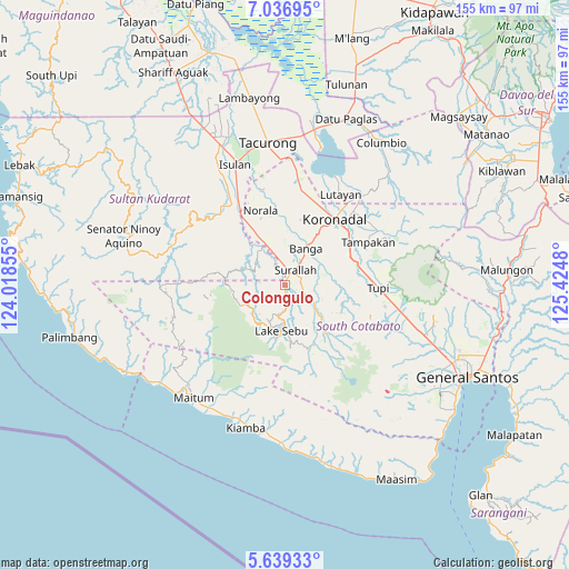
Colongulo GPS coordinates[2]
6° 20' 18.996" North, 124° 43' 18.012" East
| Map corner | latitude | longitude |
|---|---|---|
| Upper-left | 7.03695°, | 124.01855° |
| Center: | 6.33861°, | 124.72167° |
| Lower-right: | 5.63933°, | 125.4248° |
| Map W x H: | 155.4×155.4 km | = 96.6×96.6mi |
| max Lat: | 20.78733° ⇑96.5% North |
| Colongulo: | 6.33861° |
| min Lat: | ⇓3.5% South 4.65442° |
| min Long | Colongulo | max Long |
| 117.04868° | 124.72167° | 126.58417° |
| W 82.7%⇐ | ⇒17.3% E |
Elevation
Elevation of Colongulo is 200 m = 656 ft, and this is 112.1 m = 368 ft above average elevation for this country.
| Max E: |
2262 m = 7421 ft | 11% |
| Colongulo | 200 m 656 ft | |
| Avg. | 87.9 m = 288 ft | |
Min E: |
-2 m = -7 ft | 89% |
See also: Philippines elevation on elevation.city.
Geographical zone
Colongulo is located in North Torrid zone (between Equator and Tropic of Cancer). Distance of Equator is 704.8 km =437.9 mi to South.| Distance of | km | miles | from Colongulo |
|---|---|---|---|
| North Pole | 9302.3 | 5780.2 | to North |
| Arctic Circle | 6696.4 | 4160.9 | to North |
| Tropic Cancer | 1901.1 | 1181.3 | to North |
| Equator | 704.8 | 437.9 | to South |


Nearby cities:
15 places around Colongulo: (largest is in red/bold)
• Bañga
11.4 km =7.1 mi,  33°
33°
• Dahay
5.8 km =3.6 mi,  352°
352°
• Guinsang-an
14.6 km =9.1 mi,  343°
343°
• Lake Sebu
12.7 km =7.9 mi,  185°
185°
• Lamba
10.9 km =6.8 mi,  83°
83°
• Lambontong
10.4 km =6.5 mi,  108°
108°
• Lamian
14.2 km =8.8 mi,  103°
103°
• Lopez Jaena
15.5 km =9.6 mi, 350°
• Manuel Roxas
13 km =8.1 mi,  331°
331°
• San Miguel
17.3 km =10.7 mi, 350°
• San Vicente
14.3 km =8.9 mi, 26°
• Santo Niño
11 km =6.8 mi, 346°
• Sinolon
14.7 km =9.1 mi,  135°
135°
• Surallah
4.8 km =3 mi, 32°
• Teresita
8.6 km =5.3 mi, 349°
Sources, notices
• [Note1] Compared only with cities in Philippines existing in our database
• [Src1] Map data: © OpenStreetMap contributors (CC-BY-SA)
• [Src2] Other city data from geonames.org with taken over terms of usage.
• [Src3] Geographical zone / Annual Mean Temperature by Robert A. Rohde @ Wikipedia
