Lake Sebu geodata
Lake Sebu (Soccsksargen) is a populated place; located in Philippines in Asia/Manila (GMT+8) time zone. With population of 21,767 people, there are 353 cities with bigger population in this country. Compared to other cities in Philippines, 97% of cities are located further ↑North; 82.5% of cities are located further ←West and 97.5% of cities have lower elevation than Lake Sebu. Note1
Administrative division(s):
- Level 1: Soccsksargen
- Level 2: Province of South Cotabato
- Level 3: Lake Sebu


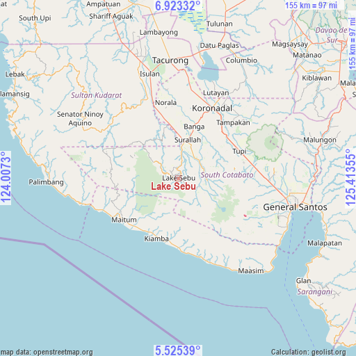
Lake Sebu GPS coordinates[2]
6° 13' 29.352" North, 124° 42' 37.512" East
| Map corner | latitude | longitude |
|---|---|---|
| Upper-left | 6.92332°, | 124.0073° |
| Center: | 6.22482°, | 124.71042° |
| Lower-right: | 5.52539°, | 125.41355° |
| Map W x H: | 155.4×155.4 km | = 96.6×96.6mi |
| max Lat: | 20.78733° ⇑97% North |
| Lake Sebu: | 6.22482° |
| min Lat: | ⇓3% South 4.65442° |
| min Long | Lake Sebu | max Long |
| 117.04868° | 124.71042° | 126.58417° |
| W 82.5%⇐ | ⇒17.5% E |
Elevation
Elevation of Lake Sebu is 690 m = 2264 ft, and this is 602.1 m = 1975 ft above average elevation for this country.
| Max E: |
2262 m = 7421 ft | 2.5% |
| Lake Sebu | 690 m 2264 ft | |
| Avg. | 87.9 m = 288 ft | |
Min E: |
-2 m = -7 ft | 97.5% |
See also: Philippines elevation on elevation.city.
Geographical zone
Lake Sebu is located in North Torrid zone (between Equator and Tropic of Cancer). Distance of Equator is 692.1 km =430.1 mi to South.| Distance of | km | miles | from Lake Sebu |
|---|---|---|---|
| North Pole | 9314.9 | 5788 | to North |
| Arctic Circle | 6709 | 4168.8 | to North |
| Tropic Cancer | 1913.8 | 1189.2 | to North |
| Equator | 692.1 | 430.1 | to South |


Nearby cities:
15 places around Lake Sebu: (largest is in red/bold)
• Bañga
23.4 km =14.5 mi,  18°
18°
• Colongulo
12.7 km =7.9 mi,  5°
5°
• Dahay
18.4 km =11.4 mi,  1°
1°
• Lamba
18.5 km =11.5 mi,  40°
40°
• Lambontong
14.4 km =8.9 mi,  50°
50°
• Lamian
17.7 km =11 mi,  58°
58°
• Lampari
21.2 km =13.2 mi, 62°
• Lunen
26.2 km =16.3 mi, 55°
• Manuel Roxas
24.6 km =15.3 mi,  348°
348°
• San Vicente
26.6 km =16.5 mi, 16°
• Santo Niño
23.4 km =14.5 mi,  356°
356°
• Sinolon
11.7 km =7.3 mi,  79°
79°
• Surallah
17.2 km =10.7 mi, 12°
• T'boli
13.9 km =8.6 mi,  101°
101°
• Teresita
21.1 km =13.1 mi, 359°
Sources, notices
• [Note1] Compared only with cities in Philippines existing in our database
• [Src1] Map data: © OpenStreetMap contributors (CC-BY-SA)
• [Src2] Other city data from geonames.org with taken over terms of usage.
• [Src3] Geographical zone / Annual Mean Temperature by Robert A. Rohde @ Wikipedia
