Lambontong geodata
Lambontong (Soccsksargen) is a populated place; located in Philippines in Asia/Manila (GMT+8) time zone. With population of 4,338 people, there are 1567 cities with bigger population in this country. Compared to other cities in Philippines, 96.7% of cities are located further ↑North; 84.7% of cities are located further ←West and 91.4% of cities have lower elevation than Lambontong. Note1
Administrative division(s):
- Level 1: Soccsksargen
- Level 2: Province of South Cotabato
- Level 3: Surallah


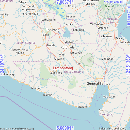
Lambontong GPS coordinates[2]
6° 18' 29.988" North, 124° 48' 38.016" East
| Map corner | latitude | longitude |
|---|---|---|
| Upper-left | 7.00671°, | 124.10744° |
| Center: | 6.30833°, | 124.81056° |
| Lower-right: | 5.60901°, | 125.51369° |
| Map W x H: | 155.4×155.4 km | = 96.6×96.6mi |
| max Lat: | 20.78733° ⇑96.7% North |
| Lambontong: | 6.30833° |
| min Lat: | ⇓3.3% South 4.65442° |
| min Long | Lambontong | max Long |
| 117.04868° | 124.81056° | 126.58417° |
| W 84.7%⇐ | ⇒15.3% E |
Elevation
Elevation of Lambontong is 271 m = 889 ft, and this is 183.1 m = 601 ft above average elevation for this country.
| Max E: |
2262 m = 7421 ft | 8.6% |
| Lambontong | 271 m 889 ft | |
| Avg. | 87.9 m = 288 ft | |
Min E: |
-2 m = -7 ft | 91.4% |
See also: Philippines elevation on elevation.city.
Geographical zone
Lambontong is located in North Torrid zone (between Equator and Tropic of Cancer). Distance of Equator is 701.4 km =435.8 mi to South.| Distance of | km | miles | from Lambontong |
|---|---|---|---|
| North Pole | 9305.6 | 5782.2 | to North |
| Arctic Circle | 6699.8 | 4163.1 | to North |
| Tropic Cancer | 1904.5 | 1183.4 | to North |
| Equator | 701.4 | 435.8 | to South |


Nearby cities:
15 places around Lambontong: (largest is in red/bold)
• Bañga
13.3 km =8.3 mi,  344°
344°
• Colongulo
10.4 km =6.5 mi,  288°
288°
• Dahay
14 km =8.7 mi,  310°
310°
• Lake Sebu
14.4 km =8.9 mi,  230°
230°
• Lamba
4.8 km =3 mi,  12°
12°
• Lamian
4 km =2.5 mi,  88°
88°
• Lampari
7.7 km =4.8 mi, 86°
• Lunen
11.8 km =7.3 mi,  61°
61°
• Palian
13.3 km =8.3 mi, 56°
• San Vicente
16.5 km =10.3 mi,  348°
348°
• Sinolon
7.2 km =4.5 mi,  176°
176°
• Surallah
10.4 km =6.5 mi,  315°
315°
• T'boli
12.3 km =7.6 mi,  168°
168°
• Teresita
16.4 km =10.2 mi, 316°
• Tupi
16 km =9.9 mi,  79°
79°
Sources, notices
• [Note1] Compared only with cities in Philippines existing in our database
• [Src1] Map data: © OpenStreetMap contributors (CC-BY-SA)
• [Src2] Other city data from geonames.org with taken over terms of usage.
• [Src3] Geographical zone / Annual Mean Temperature by Robert A. Rohde @ Wikipedia
