Kaliliog geodata
Kaliliog (Bicol) is a populated place; located in Philippines in Asia/Manila (GMT+8) time zone. With population of 2,738 people, there are 2883 cities with bigger population in this country. Compared to other cities in Philippines, 67.5% of cities are located further ↓South; 58.1% of cities are located further ←West and 98.1% of cities have higher elevation than Kaliliog. Note1


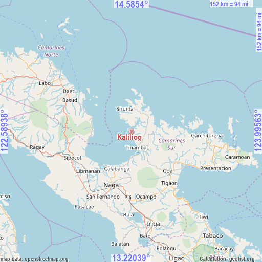
Kaliliog GPS coordinates[2]
13° 54' 14.04" North, 123° 17' 33" East
| Map corner | latitude | longitude |
|---|---|---|
| Upper-left | 14.5854°, | 122.58938° |
| Center: | 13.9039°, | 123.2925° |
| Lower-right: | 13.22039°, | 123.99563° |
| Map W x H: | 151.8×151.8 km | = 94.3×94.3mi |
| max Lat: | 20.78733° ⇑32.5% North |
| Kaliliog: | 13.9039° |
| min Lat: | ⇓67.5% South 4.65442° |
| min Long | Kaliliog | max Long |
| 117.04868° | 123.2925° | 126.58417° |
| W 58.1%⇐ | ⇒41.9% E |
Elevation
Elevation of Kaliliog is 3 m = 10 ft, and this is 84.9 m = 279 ft below average elevation for this country.
| Max E: |
2262 m = 7421 ft | 98.1% |
| Avg. | 87.9 m = 288 ft | |
| Kaliliog | 3 m = 10 ft | |
Min E: |
-2 m = -7 ft | 1.9% |
See also: Philippines elevation on elevation.city.
Geographical zone
Kaliliog is located in North Torrid zone (between Equator and Tropic of Cancer). Distance of this Northern Tropic circle is 1060 km =658.7 mi to North.| Distance of | km | miles | from Kaliliog |
|---|---|---|---|
| North Pole | 8461.1 | 5257.5 | to North |
| Arctic Circle | 5855.2 | 3638.3 | to North |
| Tropic Cancer | 1060 | 658.7 | to North |
| Equator | 1546 | 960.6 | to South |


Nearby cities:
15 places around Kaliliog: (largest is in red/bold)
• Bagacay
14.2 km =8.8 mi,  175°
175°
• Binanwanaan
22.7 km =14.1 mi, 177°
• Bombon
25.6 km =15.9 mi,  200°
200°
• Buenavista
4.2 km =2.6 mi,  165°
165°
• Calabanga
23.7 km =14.7 mi, 202°
• Manquiring
19 km =11.8 mi,  187°
187°
• Pambuhan
23.8 km =14.8 mi,  288°
288°
• Paulba
21.7 km =13.5 mi, 192°
• Pili
26.5 km =16.5 mi, 174°
• San Lucas
24 km =14.9 mi, 203°
• San Vicente
24.8 km =15.4 mi, 203°
• Santo Domingo
26.4 km =16.4 mi,  210°
210°
• Siruma
11.6 km =7.2 mi,  336°
336°
• Sogod
8.3 km =5.2 mi,  161°
161°
• Tinambac
10.4 km =6.5 mi, 159°
Sources, notices
• [Note1] Compared only with cities in Philippines existing in our database
• [Src1] Map data: © OpenStreetMap contributors (CC-BY-SA)
• [Src2] Other city data from geonames.org with taken over terms of usage.
• [Src3] Geographical zone / Annual Mean Temperature by Robert A. Rohde @ Wikipedia
