Bulatukan geodata
Bulatukan (Soccsksargen) is a populated place; located in Philippines in Asia/Manila (GMT+8) time zone. With population of 4,305 people, there are 1582 cities with bigger population in this country. Compared to other cities in Philippines, 92.5% of cities are located further ↑North; 89.9% of cities are located further ←West and 95.7% of cities have lower elevation than Bulatukan. Note1


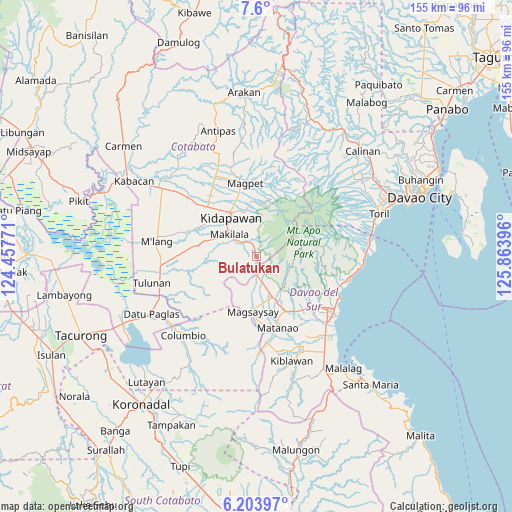
Bulatukan GPS coordinates[2]
6° 54' 9" North, 125° 9' 38.988" East
| Map corner | latitude | longitude |
|---|---|---|
| Upper-left | 7.6°, | 124.45771° |
| Center: | 6.9025°, | 125.16083° |
| Lower-right: | 6.20397°, | 125.86396° |
| Map W x H: | 155.2×155.2 km | = 96.4×96.4mi |
| max Lat: | 20.78733° ⇑92.5% North |
| Bulatukan: | 6.9025° |
| min Lat: | ⇓7.5% South 4.65442° |
| min Long | Bulatukan | max Long |
| 117.04868° | 125.16083° | 126.58417° |
| W 89.9%⇐ | ⇒10.1% E |
Elevation
Elevation of Bulatukan is 476 m = 1562 ft, and this is 388.1 m = 1273 ft above average elevation for this country.
| Max E: |
2262 m = 7421 ft | 4.3% |
| Bulatukan | 476 m 1562 ft | |
| Avg. | 87.9 m = 288 ft | |
Min E: |
-2 m = -7 ft | 95.7% |
See also: Philippines elevation on elevation.city.
Geographical zone
Bulatukan is located in North Torrid zone (between Equator and Tropic of Cancer). Distance of Equator is 767.5 km =476.9 mi to South.| Distance of | km | miles | from Bulatukan |
|---|---|---|---|
| North Pole | 9239.6 | 5741.2 | to North |
| Arctic Circle | 6633.7 | 4122 | to North |
| Tropic Cancer | 1838.4 | 1142.3 | to North |
| Equator | 767.5 | 476.9 | to South |


Nearby cities:
15 places around Bulatukan: (largest is in red/bold)
• Bansalan
14.2 km =8.8 mi,  155°
155°
• Batasan
19 km =11.8 mi,  319°
319°
• Dolo
10.8 km =6.7 mi, 161°
• Goma
21.5 km =13.4 mi,  124°
124°
• Kalaisan
17.5 km =10.9 mi,  313°
313°
• Kidapawan
14.2 km =8.8 mi,  326°
326°
• Kisante
2.4 km =1.5 mi,  344°
344°
• Magpet
22.5 km =14 mi,  347°
347°
• Magsaysay
15.3 km =9.5 mi,  170°
170°
• Makilala
8.9 km =5.5 mi, 307°
• Malasila
5.8 km =3.6 mi, 323°
• Managa
21 km =13 mi,  145°
145°
• Matti
21.9 km =13.6 mi,  131°
131°
• Saguing
12.6 km =7.8 mi, 313°
• Sinawilan
19 km =11.8 mi, 150°
Sources, notices
• [Note1] Compared only with cities in Philippines existing in our database
• [Src1] Map data: © OpenStreetMap contributors (CC-BY-SA)
• [Src2] Other city data from geonames.org with taken over terms of usage.
• [Src3] Geographical zone / Annual Mean Temperature by Robert A. Rohde @ Wikipedia
