Buang geodata
Buang (Bicol) is a populated place; located in Philippines in Asia/Manila (GMT+8) time zone. With population of 2,402 people, there are 3457 cities with bigger population in this country. Compared to other cities in Philippines, 60.2% of cities are located further ↓South; 64.6% of cities are located further ←West and 90.6% of cities have lower elevation than Buang. Note1


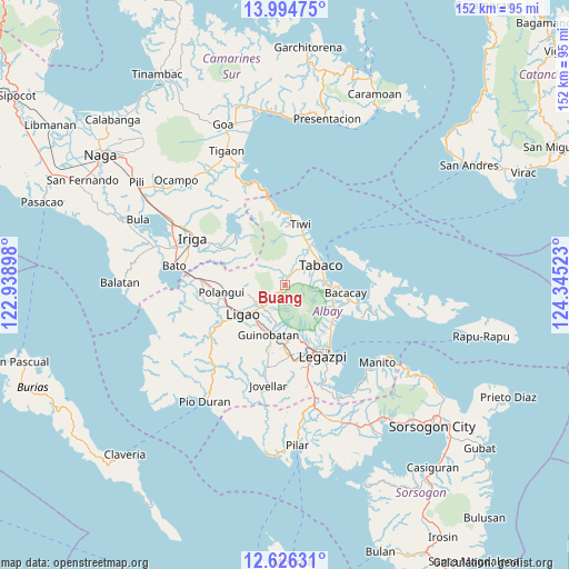
Buang GPS coordinates[2]
13° 18' 41.4" North, 123° 38' 31.56" East
| Map corner | latitude | longitude |
|---|---|---|
| Upper-left | 13.99475°, | 122.93898° |
| Center: | 13.3115°, | 123.6421° |
| Lower-right: | 12.62631°, | 124.34523° |
| Map W x H: | 152.2×152.2 km | = 94.6×94.6mi |
| max Lat: | 20.78733° ⇑39.8% North |
| Buang: | 13.3115° |
| min Lat: | ⇓60.2% South 4.65442° |
| min Long | Buang | max Long |
| 117.04868° | 123.6421° | 126.58417° |
| W 64.6%⇐ | ⇒35.4% E |
Elevation
Elevation of Buang is 240 m = 787 ft, and this is 152.1 m = 499 ft above average elevation for this country.
| Max E: |
2262 m = 7421 ft | 9.4% |
| Buang | 240 m 787 ft | |
| Avg. | 87.9 m = 288 ft | |
Min E: |
-2 m = -7 ft | 90.6% |
See also: Philippines elevation on elevation.city.
Geographical zone
Buang is located in North Torrid zone (between Equator and Tropic of Cancer). Distance of this Northern Tropic circle is 1125.8 km =699.5 mi to North.| Distance of | km | miles | from Buang |
|---|---|---|---|
| North Pole | 8527 | 5298.4 | to North |
| Arctic Circle | 5921.1 | 3679.2 | to North |
| Tropic Cancer | 1125.8 | 699.5 | to North |
| Equator | 1480.1 | 919.7 | to South |


Nearby cities:
15 places around Buang: (largest is in red/bold)
• Balinad
10.7 km =6.6 mi,  258°
258°
• Balogo
10.4 km =6.5 mi,  254°
254°
• Banag
10 km =6.2 mi,  41°
41°
• Batana
10.9 km =6.8 mi,  230°
230°
• Estancia
6.7 km =4.2 mi, 37°
• Herrera
8.5 km =5.3 mi,  236°
236°
• Labnig
8.3 km =5.2 mi,  28°
28°
• Mahaba
11 km =6.8 mi, 243°
• Malilipot
10.5 km =6.5 mi,  85°
85°
• Masaraway
9.9 km =6.2 mi,  197°
197°
• Miliroc
7.5 km =4.7 mi,  60°
60°
• Muladbucad
9 km =5.6 mi,  206°
206°
• San Jose
10.8 km =6.7 mi,  293°
293°
• Sugcad
8.8 km =5.5 mi,  45°
45°
• Tabaco
11.2 km =7 mi, 62°
Sources, notices
• [Note1] Compared only with cities in Philippines existing in our database
• [Src1] Map data: © OpenStreetMap contributors (CC-BY-SA)
• [Src2] Other city data from geonames.org with taken over terms of usage.
• [Src3] Geographical zone / Annual Mean Temperature by Robert A. Rohde @ Wikipedia
