Banag geodata
Banag (Bicol) is a populated place; located in Philippines in Asia/Manila (GMT+8) time zone. With population of 2,775 people, there are 2831 cities with bigger population in this country. Compared to other cities in Philippines, 61% of cities are located further ↓South; 65.7% of cities are located further ←West and 70.2% of cities have higher elevation than Banag. Note1


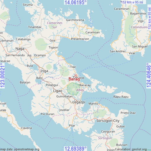
Banag GPS coordinates[2]
13° 22' 44.004" North, 123° 42' 11.988" East
| Map corner | latitude | longitude |
|---|---|---|
| Upper-left | 14.06195°, | 123.00021° |
| Center: | 13.37889°, | 123.70333° |
| Lower-right: | 12.69389°, | 124.40646° |
| Map W x H: | 152.1×152.1 km | = 94.5×94.5mi |
| max Lat: | 20.78733° ⇑39% North |
| Banag: | 13.37889° |
| min Lat: | ⇓61% South 4.65442° |
| min Long | Banag | max Long |
| 117.04868° | 123.70333° | 126.58417° |
| W 65.7%⇐ | ⇒34.3% E |
Elevation
Elevation of Banag is 12 m = 39 ft, and this is 75.9 m = 249 ft below average elevation for this country.
| Max E: |
2262 m = 7421 ft | 70.2% |
| Avg. | 87.9 m = 288 ft | |
| Banag | 12 m = 39 ft | |
Min E: |
-2 m = -7 ft | 29.8% |
See also: Philippines elevation on elevation.city.
Geographical zone
Banag is located in North Torrid zone (between Equator and Tropic of Cancer). Distance of this Northern Tropic circle is 1118.3 km =694.9 mi to North.| Distance of | km | miles | from Banag |
|---|---|---|---|
| North Pole | 8519.5 | 5293.8 | to North |
| Arctic Circle | 5913.6 | 3674.5 | to North |
| Tropic Cancer | 1118.3 | 694.9 | to North |
| Equator | 1487.6 | 924.4 | to South |


Nearby cities:
15 places around Banag: (largest is in red/bold)
• Bagumbayan
8.8 km =5.5 mi,  333°
333°
• Balading
1.6 km =1 mi,  36°
36°
• Baybay
3.5 km =2.2 mi,  18°
18°
• Buang
10 km =6.2 mi,  221°
221°
• Estancia
3.4 km =2.1 mi,  229°
229°
• Labnig
2.7 km =1.7 mi,  265°
265°
• Malilipot
7.7 km =4.8 mi,  150°
150°
• Malinao
2.3 km =1.4 mi,  9°
9°
• Miliroc
3.8 km =2.4 mi,  182°
182°
• Naagas
6.9 km =4.3 mi,  336°
336°
• San Francisco
8.6 km =5.3 mi,  143°
143°
• Sugcad
1.4 km =0.9 mi,  194°
194°
• Tabaco
4 km =2.5 mi,  124°
124°
• Tagoytoy
4.9 km =3 mi, 326°
• Tiwi
9.2 km =5.7 mi, 344°
Sources, notices
• [Note1] Compared only with cities in Philippines existing in our database
• [Src1] Map data: © OpenStreetMap contributors (CC-BY-SA)
• [Src2] Other city data from geonames.org with taken over terms of usage.
• [Src3] Geographical zone / Annual Mean Temperature by Robert A. Rohde @ Wikipedia
