Biri geodata
Biri (Eastern Visayas) is a seat of a third-order administrative division; located in Philippines in Asia/Manila (GMT+8) time zone. With population of 2,597 people, there are 3112 cities with bigger population in this country. Compared to other cities in Philippines, 56% of cities are located further ↓South; 76.7% of cities are located further ←West and 99.6% of cities have higher elevation than Biri. Note1
Administrative division(s):
- Level 1: Eastern Visayas
- Level 2: Province of Northern Samar
- Level 3: Biri


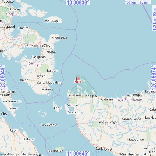
Biri GPS coordinates[2]
12° 40' 59.988" North, 124° 21' 48.996" East
| Map corner | latitude | longitude |
|---|---|---|
| Upper-left | 13.36836°, | 123.66049° |
| Center: | 12.68333°, | 124.36361° |
| Lower-right: | 11.99645°, | 125.06674° |
| Map W x H: | 152.5×152.5 km | = 94.8×94.8mi |
| max Lat: | 20.78733° ⇑44% North |
| Biri: | 12.68333° |
| min Lat: | ⇓56% South 4.65442° |
| min Long | Biri | max Long |
| 117.04868° | 124.36361° | 126.58417° |
| W 76.7%⇐ | ⇒23.3% E |
Elevation
Elevation of Biri is 1 m = 3 ft, and this is 86.9 m = 285 ft below average elevation for this country.
| Max E: |
2262 m = 7421 ft | 99.6% |
| Avg. | 87.9 m = 288 ft | |
| Biri | 1 m = 3 ft | |
Min E: |
-2 m = -7 ft | 0.4% |
See also: Philippines elevation on elevation.city.
Geographical zone
Biri is located in North Torrid zone (between Equator and Tropic of Cancer). Distance of this Northern Tropic circle is 1195.7 km =743 mi to North.| Distance of | km | miles | from Biri |
|---|---|---|---|
| North Pole | 8596.8 | 5341.8 | to North |
| Arctic Circle | 5990.9 | 3722.6 | to North |
| Tropic Cancer | 1195.7 | 743 | to North |
| Equator | 1410.3 | 876.3 | to South |


Nearby cities:
15 places around Biri: (largest is in red/bold)
• Alegria
31.9 km =19.8 mi,  187°
187°
• Allen
22 km =13.7 mi,  202°
202°
• Barcelona
31.6 km =19.6 mi,  310°
310°
• Bobon
28 km =17.4 mi,  129°
129°
• Bulusan
27.3 km =17 mi,  285°
285°
• Erenas
29.1 km =18.1 mi, 188°
• Jubasan
23.6 km =14.7 mi, 200°
• Lavezares
17 km =10.6 mi, 192°
• Matnog
31.8 km =19.8 mi,  250°
250°
• Rosario
19.1 km =11.9 mi,  159°
159°
• San Antonio
31.4 km =19.5 mi, 196°
• San Jose
21.7 km =13.5 mi,  141°
141°
• San Roque
31 km =19.3 mi,  281°
281°
• Santa Magdalena
27.9 km =17.3 mi,  261°
261°
• Victoria
26.9 km =16.7 mi, 192°
Sources, notices
• [Note1] Compared only with cities in Philippines existing in our database
• [Src1] Map data: © OpenStreetMap contributors (CC-BY-SA)
• [Src2] Other city data from geonames.org with taken over terms of usage.
• [Src3] Geographical zone / Annual Mean Temperature by Robert A. Rohde @ Wikipedia
