Bau geodata
Bau (Soccsksargen) is a populated place; located in Philippines in Asia/Manila (GMT+8) time zone. With population of 6,672 people, there are 937 cities with bigger population in this country. Compared to other cities in Philippines, 87.7% of cities are located further ↑North; 81.6% of cities are located further ←West and 86.8% of cities have lower elevation than Bau. Note1


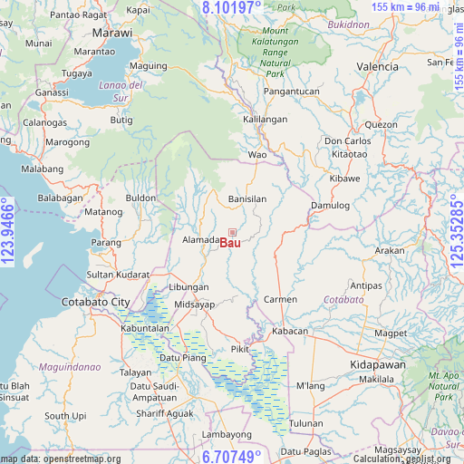
Bau GPS coordinates[2]
7° 24' 19.008" North, 124° 38' 58.992" East
| Map corner | latitude | longitude |
|---|---|---|
| Upper-left | 8.10197°, | 123.9466° |
| Center: | 7.40528°, | 124.64972° |
| Lower-right: | 6.70749°, | 125.35285° |
| Map W x H: | 155.1×155.1 km | = 96.4×96.4mi |
| max Lat: | 20.78733° ⇑87.7% North |
| Bau: | 7.40528° |
| min Lat: | ⇓12.3% South 4.65442° |
| min Long | Bau | max Long |
| 117.04868° | 124.64972° | 126.58417° |
| W 81.6%⇐ | ⇒18.4% E |
Elevation
Elevation of Bau is 162 m = 531 ft, and this is 74.1 m = 243 ft above average elevation for this country.
| Max E: |
2262 m = 7421 ft | 13.2% |
| Bau | 162 m 531 ft | |
| Avg. | 87.9 m = 288 ft | |
Min E: |
-2 m = -7 ft | 86.8% |
See also: Philippines elevation on elevation.city.
Geographical zone
Bau is located in North Torrid zone (between Equator and Tropic of Cancer). Distance of Equator is 823.4 km =511.6 mi to South.| Distance of | km | miles | from Bau |
|---|---|---|---|
| North Pole | 9183.7 | 5706.5 | to North |
| Arctic Circle | 6577.8 | 4087.3 | to North |
| Tropic Cancer | 1782.5 | 1107.6 | to North |
| Equator | 823.4 | 511.6 | to South |


Nearby cities:
15 places around Bau: (largest is in red/bold)
• Alamada
12.2 km =7.6 mi,  228°
228°
• Baguer
23.1 km =14.4 mi,  224°
224°
• Balogo
24.6 km =15.3 mi,  236°
236°
• Banisilan
12.6 km =7.8 mi,  40°
40°
• Barongis
18.6 km =11.6 mi,  210°
210°
• Buayan
20.8 km =12.9 mi, 219°
• Libungan
23.2 km =14.4 mi, 218°
• Liliongan
16.5 km =10.3 mi,  106°
106°
• Malinao
18.4 km =11.4 mi,  20°
20°
• Malitubog
10.1 km =6.3 mi,  187°
187°
• Midsayap
27.2 km =16.9 mi, 208°
• Nuyo
26.4 km =16.4 mi,  273°
273°
• Patindeguen
26.5 km =16.5 mi, 218°
• Tomado
24.1 km =15 mi, 190°
• Upper San Mateo
26.9 km =16.7 mi,  196°
196°
Sources, notices
• [Note1] Compared only with cities in Philippines existing in our database
• [Src1] Map data: © OpenStreetMap contributors (CC-BY-SA)
• [Src2] Other city data from geonames.org with taken over terms of usage.
• [Src3] Geographical zone / Annual Mean Temperature by Robert A. Rohde @ Wikipedia
