Basiad geodata
Basiad (Bicol) is a populated place; located in Philippines in Asia/Manila (GMT+8) time zone. With population of 2,849 people, there are 2704 cities with bigger population in this country. Compared to other cities in Philippines, 71.2% of cities are located further ↓South; 56.9% of cities are located further →East and 95.5% of cities have higher elevation than Basiad. Note1
Administrative division(s):
- Level 1: Bicol
- Level 2: Province of Camarines Norte
- Level 3: Santa Elena


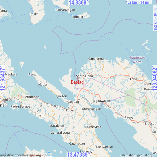
Basiad GPS coordinates[2]
14° 9' 22.212" North, 122° 20' 14.964" East
| Map corner | latitude | longitude |
|---|---|---|
| Upper-left | 14.8369°, | 121.63437° |
| Center: | 14.15617°, | 122.33749° |
| Lower-right: | 13.47339°, | 123.04062° |
| Map W x H: | 151.6×151.6 km | = 94.2×94.2mi |
| max Lat: | 20.78733° ⇑28.8% North |
| Basiad: | 14.15617° |
| min Lat: | ⇓71.2% South 4.65442° |
| min Long | Basiad | max Long |
| 117.04868° | 122.33749° | 126.58417° |
| W 43.1%⇐ | ⇒56.9% E |
Elevation
Elevation of Basiad is 5 m = 16 ft, and this is 82.9 m = 272 ft below average elevation for this country.
| Max E: |
2262 m = 7421 ft | 95.5% |
| Avg. | 87.9 m = 288 ft | |
| Basiad | 5 m = 16 ft | |
Min E: |
-2 m = -7 ft | 4.5% |
See also: Philippines elevation on elevation.city.
Geographical zone
Basiad is located in North Torrid zone (between Equator and Tropic of Cancer). Distance of this Northern Tropic circle is 1031.9 km =641.2 mi to North.| Distance of | km | miles | from Basiad |
|---|---|---|---|
| North Pole | 8433 | 5240 | to North |
| Arctic Circle | 5827.2 | 3620.9 | to North |
| Tropic Cancer | 1031.9 | 641.2 | to North |
| Equator | 1574 | 978 | to South |


Nearby cities:
15 places around Basiad: (largest is in red/bold)
• Alayao
27 km =16.8 mi,  58°
58°
• Calabaca
19.1 km =11.9 mi,  32°
32°
• Calauag
22.7 km =14.1 mi,  193°
193°
• Capalonga
25.7 km =16 mi,  40°
40°
• Hondagua
25.6 km =15.9 mi,  203°
203°
• Kinatakutan
26.4 km =16.4 mi,  147°
147°
• Malatap
19.1 km =11.9 mi,  79°
79°
• Mapulot
25.8 km =16 mi,  122°
122°
• Palali
23.1 km =14.4 mi, 43°
• Quezon
23.6 km =14.7 mi,  224°
224°
• Rizal
23.7 km =14.7 mi, 194°
• Santa Cecilia
15.7 km =9.8 mi,  248°
248°
• Santa Elena
5.1 km =3.2 mi,  72°
72°
• Tagkawayan Sabang
27.7 km =17.2 mi,  131°
131°
• Tigbinan
14.6 km =9.1 mi, 76°
Sources, notices
• [Note1] Compared only with cities in Philippines existing in our database
• [Src1] Map data: © OpenStreetMap contributors (CC-BY-SA)
• [Src2] Other city data from geonames.org with taken over terms of usage.
• [Src3] Geographical zone / Annual Mean Temperature by Robert A. Rohde @ Wikipedia
