San Miguel geodata
San Miguel (Northern Mindanao) is a populated place; located in Philippines in Asia/Manila (GMT+8) time zone. With population of 5,054 people, there are 1276 cities with bigger population in this country. Compared to other cities in Philippines, 82.4% of cities are located further ↑North; 83.3% of cities are located further ←West and 99.6% of cities have lower elevation than San Miguel. Note1
Administrative division(s):
- Level 1: Northern Mindanao
- Level 2: Province of Bukidnon
- Level 3: Talakag


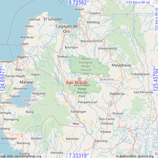
San Miguel GPS coordinates[2]
8° 1' 48" North, 124° 45' 14.004" East
| Map corner | latitude | longitude |
|---|---|---|
| Upper-left | 8.72562°, | 124.05077° |
| Center: | 8.03°, | 124.75389° |
| Lower-right: | 7.33319°, | 125.45702° |
| Map W x H: | 154.8×154.8 km | = 96.2×96.2mi |
| max Lat: | 20.78733° ⇑82.4% North |
| San Miguel: | 8.03° |
| min Lat: | ⇓17.6% South 4.65442° |
| min Long | San Miguel | max Long |
| 117.04868° | 124.75389° | 126.58417° |
| W 83.3%⇐ | ⇒16.7% E |
Elevation
Elevation of San Miguel is 1314 m = 4311 ft, and this is 1226.1 m = 4023 ft above average elevation for this country.
| Max E: |
2262 m = 7421 ft | 0.40000000000001% |
| San Miguel | 1314 m 4311 ft | |
| Avg. | 87.9 m = 288 ft | |
Min E: |
-2 m = -7 ft | 99.6% |
See also: Philippines elevation on elevation.city.
Geographical zone
San Miguel is located in North Torrid zone (between Equator and Tropic of Cancer). Distance of Equator is 892.9 km =554.8 mi to South.| Distance of | km | miles | from San Miguel |
|---|---|---|---|
| North Pole | 9114.2 | 5663.3 | to North |
| Arctic Circle | 6508.3 | 4044.1 | to North |
| Tropic Cancer | 1713.1 | 1064.5 | to North |
| Equator | 892.9 | 554.8 | to South |


Nearby cities:
15 places around San Miguel: (largest is in red/bold)
• Adtugan
26.7 km =16.6 mi,  155°
155°
• Alanib
25.6 km =15.9 mi,  90°
90°
• Bangahan
26.1 km =16.2 mi,  184°
184°
• Basak
12.1 km =7.5 mi,  84°
84°
• Cosina
17 km =10.6 mi,  299°
299°
• Dagumba-an
22.6 km =14 mi,  307°
307°
• Indulang
19.8 km =12.3 mi,  289°
289°
• Kibangay
15.5 km =9.6 mi, 81°
• La Roxas
23.6 km =14.7 mi,  141°
141°
• Lingion
23.7 km =14.7 mi,  317°
317°
• Lurugan
23.5 km =14.6 mi, 93°
• Pangantocan
21.3 km =13.2 mi, 162°
• Pongol
27.6 km =17.1 mi,  358°
358°
• Salimbalan
27.4 km =17 mi,  352°
352°
• Ticala-an
14.7 km =9.1 mi,  272°
272°
Sources, notices
• [Note1] Compared only with cities in Philippines existing in our database
• [Src1] Map data: © OpenStreetMap contributors (CC-BY-SA)
• [Src2] Other city data from geonames.org with taken over terms of usage.
• [Src3] Geographical zone / Annual Mean Temperature by Robert A. Rohde @ Wikipedia
