Avila geodata
Avila (Western Visayas) is a populated place; located in Philippines in Asia/Manila (GMT+8) time zone. With population of 2,349 people, there are 3562 cities with bigger population in this country. Compared to other cities in Philippines, 61% of cities are located further ↑North; 51.4% of cities are located further →East and 68% of cities have lower elevation than Avila. Note1
Administrative division(s):
- Level 1: Western Visayas
- Level 2: Province of Guimaras
- Level 3: Buenavista


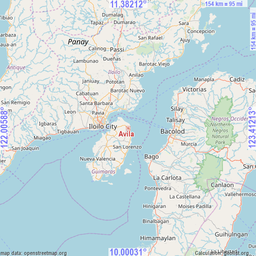
Avila GPS coordinates[2]
10° 41' 31.2" North, 122° 42' 32.4" East
| Map corner | latitude | longitude |
|---|---|---|
| Upper-left | 11.38212°, | 122.00588° |
| Center: | 10.692°, | 122.709° |
| Lower-right: | 10.00031°, | 123.41213° |
| Map W x H: | 153.6×153.6 km | = 95.4×95.4mi |
| max Lat: | 20.78733° ⇑61% North |
| Avila: | 10.692° |
| min Lat: | ⇓39% South 4.65442° |
| min Long | Avila | max Long |
| 117.04868° | 122.709° | 126.58417° |
| W 48.6%⇐ | ⇒51.4% E |
Elevation
Elevation of Avila is 48 m = 157 ft, and this is 39.9 m = 131 ft below average elevation for this country.
| Max E: |
2262 m = 7421 ft | 32% |
| Avg. | 87.9 m = 288 ft | |
| Avila | 48 m = 157 ft | |
Min E: |
-2 m = -7 ft | 68% |
See also: Philippines elevation on elevation.city.
Geographical zone
Avila is located in North Torrid zone (between Equator and Tropic of Cancer). Distance of Equator is 1188.8 km =738.7 mi to South.| Distance of | km | miles | from Avila |
|---|---|---|---|
| North Pole | 8818.2 | 5479.4 | to North |
| Arctic Circle | 6212.3 | 3860.1 | to North |
| Tropic Cancer | 1417.1 | 880.5 | to North |
| Equator | 1188.8 | 738.7 | to South |


Nearby cities:
15 places around Avila: (largest is in red/bold)
• Buenavista
9 km =5.6 mi,  276°
276°
• Cabano
11.7 km =7.3 mi,  184°
184°
• Constancia
13 km =8.1 mi,  214°
214°
• Dumangas
14.8 km =9.2 mi,  1°
1°
• East Valencia
2.7 km =1.7 mi, 177°
• Getulio
7.7 km =4.8 mi,  322°
322°
• Iloilo
15.8 km =9.8 mi,  271°
271°
• Jordan
12.9 km =8 mi,  253°
253°
• Leganes
16.8 km =10.4 mi,  308°
308°
• Piña
9.7 km =6 mi,  232°
232°
• Rizal
8.3 km =5.2 mi,  263°
263°
• Salvacion
10.1 km =6.3 mi, 264°
• San Enrique
4.3 km =2.7 mi,  168°
168°
• San Miguel
16.8 km =10.4 mi, 230°
• Sulangan
15.5 km =9.6 mi,  352°
352°
Sources, notices
• [Note1] Compared only with cities in Philippines existing in our database
• [Src1] Map data: © OpenStreetMap contributors (CC-BY-SA)
• [Src2] Other city data from geonames.org with taken over terms of usage.
• [Src3] Geographical zone / Annual Mean Temperature by Robert A. Rohde @ Wikipedia
