Salvacion geodata
Salvacion (Bicol) is a populated place; located in Philippines in Asia/Manila (GMT+8) time zone. With population of 2,835 people, there are 2731 cities with bigger population in this country. Compared to other cities in Philippines, 57.9% of cities are located further ↓South; 64.2% of cities are located further ←West and 81.5% of cities have lower elevation than Salvacion. Note1


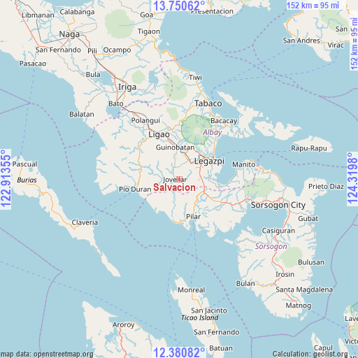
Salvacion GPS coordinates[2]
13° 4' 0.012" North, 123° 37' 0.012" East
| Map corner | latitude | longitude |
|---|---|---|
| Upper-left | 13.75062°, | 122.91355° |
| Center: | 13.06667°, | 123.61667° |
| Lower-right: | 12.38082°, | 124.3198° |
| Map W x H: | 152.3×152.3 km | = 94.6×94.6mi |
| max Lat: | 20.78733° ⇑42.1% North |
| Salvacion: | 13.06667° |
| min Lat: | ⇓57.9% South 4.65442° |
| min Long | Salvacion | max Long |
| 117.04868° | 123.61667° | 126.58417° |
| W 64.2%⇐ | ⇒35.8% E |
Elevation
Elevation of Salvacion is 103 m = 338 ft, and this is 15.1 m = 50 ft above average elevation for this country.
| Max E: |
2262 m = 7421 ft | 18.5% |
| Salvacion | 103 m 338 ft | |
| Avg. | 87.9 m = 288 ft | |
Min E: |
-2 m = -7 ft | 81.5% |
See also: Philippines elevation on elevation.city.
Geographical zone
Salvacion is located in North Torrid zone (between Equator and Tropic of Cancer). Distance of this Northern Tropic circle is 1153 km =716.4 mi to North.| Distance of | km | miles | from Salvacion |
|---|---|---|---|
| North Pole | 8554.2 | 5315.3 | to North |
| Arctic Circle | 5948.3 | 3696.1 | to North |
| Tropic Cancer | 1153 | 716.4 | to North |
| Equator | 1452.9 | 902.8 | to South |


Nearby cities:
15 places around Salvacion: (largest is in red/bold)
• Aanislag
9.4 km =5.8 mi,  84°
84°
• Abucay
10.1 km =6.3 mi,  159°
159°
• Baligang
10.1 km =6.3 mi,  16°
16°
• Barayong
11.4 km =7.1 mi,  71°
71°
• Bascaron
9.9 km =6.2 mi, 65°
• Camalig
13.5 km =8.4 mi, 17°
• Cotmon
7.6 km =4.7 mi,  42°
42°
• Daraga
13.8 km =8.6 mi,  48°
48°
• Guinobatan
14 km =8.7 mi,  352°
352°
• Jovellar
1.8 km =1.1 mi,  279°
279°
• Lacag
12.1 km =7.5 mi, 35°
• Mauraro
9.5 km =5.9 mi, 345°
• Putiao
11.9 km =7.4 mi,  116°
116°
• Tinago
13.5 km =8.4 mi, 15°
• Villahermosa
10.7 km =6.6 mi,  102°
102°
Sources, notices
• [Note1] Compared only with cities in Philippines existing in our database
• [Src1] Map data: © OpenStreetMap contributors (CC-BY-SA)
• [Src2] Other city data from geonames.org with taken over terms of usage.
• [Src3] Geographical zone / Annual Mean Temperature by Robert A. Rohde @ Wikipedia
