Putiao geodata
Putiao (Bicol) is a populated place; located in Philippines in Asia/Manila (GMT+8) time zone. With population of 2,303 people, there are 3678 cities with bigger population in this country. Compared to other cities in Philippines, 57.5% of cities are located further ↓South; 66% of cities are located further ←West and 60.8% of cities have higher elevation than Putiao. Note1


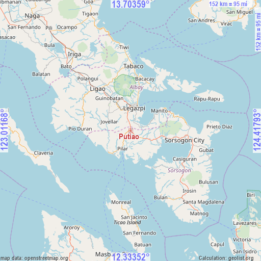
Putiao GPS coordinates[2]
13° 1' 10.2" North, 123° 42' 53.28" East
| Map corner | latitude | longitude |
|---|---|---|
| Upper-left | 13.70359°, | 123.01168° |
| Center: | 13.0195°, | 123.7148° |
| Lower-right: | 12.33352°, | 124.41793° |
| Map W x H: | 152.3×152.3 km | = 94.6×94.6mi |
| max Lat: | 20.78733° ⇑42.5% North |
| Putiao: | 13.0195° |
| min Lat: | ⇓57.5% South 4.65442° |
| min Long | Putiao | max Long |
| 117.04868° | 123.7148° | 126.58417° |
| W 66%⇐ | ⇒34% E |
Elevation
Elevation of Putiao is 16 m = 52 ft, and this is 71.9 m = 236 ft below average elevation for this country.
| Max E: |
2262 m = 7421 ft | 60.8% |
| Avg. | 87.9 m = 288 ft | |
| Putiao | 16 m = 52 ft | |
Min E: |
-2 m = -7 ft | 39.2% |
See also: Philippines elevation on elevation.city.
Geographical zone
Putiao is located in North Torrid zone (between Equator and Tropic of Cancer). Distance of this Northern Tropic circle is 1158.3 km =719.7 mi to North.| Distance of | km | miles | from Putiao |
|---|---|---|---|
| North Pole | 8559.4 | 5318.6 | to North |
| Arctic Circle | 5953.5 | 3699.3 | to North |
| Tropic Cancer | 1158.3 | 719.7 | to North |
| Equator | 1447.6 | 899.5 | to South |


Nearby cities:
15 places around Putiao: (largest is in red/bold)
• Aanislag
6.3 km =3.9 mi,  348°
348°
• Abucay
8.2 km =5.1 mi,  239°
239°
• Bangkirohan
5.3 km =3.3 mi,  41°
41°
• Barayong
9 km =5.6 mi,  1°
1°
• Bariw
12.8 km =8 mi,  9°
9°
• Bascaron
9.4 km =5.8 mi, 350°
• Cabiguan
12.8 km =8 mi,  171°
171°
• Cotmon
12.2 km =7.6 mi,  333°
333°
• Cumadcad
9.1 km =5.7 mi,  118°
118°
• Maslog
11.3 km =7 mi,  32°
32°
• Pilar
11.7 km =7.3 mi,  203°
203°
• Salvacion
11.9 km =7.4 mi,  296°
296°
• San Francisco
7.7 km =4.8 mi,  75°
75°
• San Vicente
12.5 km =7.8 mi,  111°
111°
• Villahermosa
2.9 km =1.8 mi,  356°
356°
Sources, notices
• [Note1] Compared only with cities in Philippines existing in our database
• [Src1] Map data: © OpenStreetMap contributors (CC-BY-SA)
• [Src2] Other city data from geonames.org with taken over terms of usage.
• [Src3] Geographical zone / Annual Mean Temperature by Robert A. Rohde @ Wikipedia
