Sambayanihan People's Village geodata
Sambayanihan People's Village (Metro Manila) is a section of populated place; located in Philippines in Asia/Manila (GMT+8) time zone. With population of 2,500 people, there are 3288 cities with bigger population in this country. Compared to other cities in Philippines, 73.9% of cities are located further ↓South; 76.4% of cities are located further →East and 53.1% of cities have higher elevation than Sambayanihan People's Village. Note1
Administrative division(s):
- Level 1: Metro Manila
- Level 2: Southern Manila District
- Level 3: City of Las Piñas
Current local time in Sambayanihan People's Village:
01:56 AM, TuesdayDifference from your time zone: hours


Sambayanihan People's Village GPS coordinates[2]
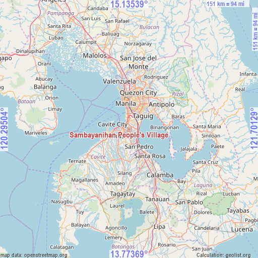
14° 27' 20.088" North, 120° 59' 53.376" East
| Map corner | latitude | longitude |
|---|---|---|
| Upper-left | 15.13539°, | 120.29504° |
| Center: | 14.45558°, | 120.99816° |
| Lower-right: | 13.77369°, | 121.70129° |
| Map W x H: | 151.4×151.4 km | = 94.1×94.1mi |
| max Lat: | 20.78733° ⇑26.1% North |
| Sambayanihan People's Village: | 14.45558° |
| min Lat: | ⇓73.9% South 4.65442° |
| min Long | Sambayanihan Pe | max Long |
| 117.04868° | 120.99816° | 126.58417° |
| W 23.6%⇐ | ⇒76.4% E |
Elevation
Elevation of Sambayanihan People's Village is 21 m = 69 ft, and this is 66.9 m = 219 ft below average elevation for this country.
| Max E: |
2262 m = 7421 ft | 53.1% |
| Avg. | 87.9 m = 288 ft | |
| Sambayanihan People's Village | 21 m = 69 ft | |
Min E: |
-2 m = -7 ft | 46.9% |
See also: Philippines elevation on elevation.city.
Geographical zone
Sambayanihan People's Village is located in North Torrid zone (between Equator and Tropic of Cancer). Distance of this Northern Tropic circle is 998.6 km =620.5 mi to North.| Distance of | km | miles | from Sambayanihan People's Village |
|---|---|---|---|
| North Pole | 8399.8 | 5219.4 | to North |
| Arctic Circle | 5793.9 | 3600.2 | to North |
| Tropic Cancer | 998.6 | 620.5 | to North |
| Equator | 1607.3 | 998.7 | to South |


Nearby cities:
15 places around Sambayanihan People's Village: (largest is in red/bold)
• Bacoor
6.4 km =4 mi,  273°
273°
• Cavite City
11.1 km =6.9 mi,  286°
286°
• Imus
7.2 km =4.5 mi,  246°
246°
• Kawit
10.5 km =6.5 mi,  263°
263°
• Las Piñas
1.7 km =1.1 mi, 251°
• Magsaysay
13.5 km =8.4 mi,  163°
163°
• Makati City
11.2 km =7 mi,  19°
19°
• Muntinlupa
9 km =5.6 mi,  143°
143°
• Noveleta
13.1 km =8.1 mi, 257°
• Pasay
9.1 km =5.7 mi,  2°
2°
• Pateros
12.3 km =7.6 mi,  40°
40°
• Port Area
14.6 km =9.1 mi,  346°
346°
• San Pedro
11.9 km =7.4 mi,  153°
153°
• Santa Rosa
13.2 km =8.2 mi, 255°
• Taguig
11.6 km =7.2 mi,  48°
48°
Sources, notices
• [Note1] Compared only with cities in Philippines existing in our database
• [Src1] Map data: © OpenStreetMap contributors (CC-BY-SA)
• [Src2] Other city data from geonames.org with taken over terms of usage.
• [Src3] Geographical zone / Annual Mean Temperature by Robert A. Rohde @ Wikipedia
