Shekhupura geodata
Shekhupura (Punjab) is a seat of a second-order administrative division; located in Pakistan in Asia/Karachi (GMT+5) time zone. With population of 361,303 people, there are 19 cities with bigger population in this country. Compared to other cities in Pakistan, 60.7% of cities are located further ↓South; 90.1% of cities are located further ←West and 61.6% of cities have lower elevation than Shekhupura. Note1


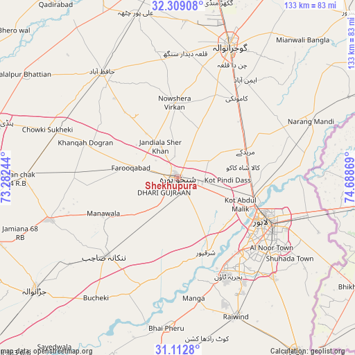
Shekhupura GPS coordinates[2]
31° 42' 46.332" North, 73° 59' 8.016" East
| Map corner | latitude | longitude |
|---|---|---|
| Upper-left | 32.30908°, | 73.28244° |
| Center: | 31.71287°, | 73.98556° |
| Lower-right: | 31.1128°, | 74.68869° |
| Map W x H: | 133×133 km | = 82.6×82.6mi |
| max Lat: | 36.32162° ⇑39.3% North |
| Shekhupura: | 31.71287° |
| min Lat: | ⇓60.7% South 24.14422° |
| min Long | Shekhupura | max Long |
| 61.74573° | 73.98556° | 75.63372° |
| W 90.1%⇐ | ⇒9.9% E |
Elevation
Elevation of Shekhupura is 210 m = 689 ft, and this is 135 m = 443 ft below average elevation for this country.
| Max E: |
2732 m = 8963 ft | 38.4% |
| Avg. | 345 m = 1132 ft | |
| Shekhupura | 210 m = 689 ft | |
Min E: |
3 m = 10 ft | 61.6% |
See also: Shekhupura elevation on elevation.city.
Geographical zone
Shekhupura is located in North temperate zone (between Tropic of Cancer and the Arctic Circle). Distance of this Northern Tropic circle is 920.2 km =571.8 mi to South.| Distance of | km | miles | from Shekhupura |
|---|---|---|---|
| North Pole | 6480.9 | 4027 | to North |
| Arctic Circle | 3875 | 2407.8 | to North |
| Tropic Cancer | 920.2 | 571.8 | to South |
| Equator | 3526.1 | 2191 | to South |


Nearby cities:
15 places around Shekhupura: (largest is in red/bold)
• Chak Five Hundred Seventy-five
23.8 km =14.8 mi,  218°
218°
• Chuchar-kana Mandi
18 km =11.2 mi,  283°
283°
• Eminabad
44.9 km =27.9 mi,  35°
35°
• Hafizabad
48.7 km =30.3 mi,  324°
324°
• Jandiala Sher Khan
13.6 km =8.5 mi,  332°
332°
• Kaleke Mandi
46.7 km =29 mi,  308°
308°
• Kamoke
36.8 km =22.9 mi, 37°
• Khangah Dogran
36.9 km =22.9 mi,  291°
291°
• Lahore
38.6 km =24 mi,  116°
116°
• Mananwala
31.3 km =19.4 mi,  243°
243°
• Muridke
27.6 km =17.1 mi,  68°
68°
• Nankana Sahib
39.4 km =24.5 mi, 222°
• Naushahra Virkan
27.8 km =17.3 mi,  357°
357°
• Sharqpur Sharif
30 km =18.6 mi,  158°
158°
• Sukheke Mandi
48.1 km =29.9 mi, 290°
Sources, notices
• [Note1] Compared only with cities in Pakistan existing in our database
• [Src1] Map data: © OpenStreetMap contributors (CC-BY-SA)
• [Src2] Other city data from geonames.org with taken over terms of usage.
• [Src3] Geographical zone / Annual Mean Temperature by Robert A. Rohde @ Wikipedia
