Mananwala geodata
Mananwala (Punjab) is a populated place; located in Pakistan in Asia/Karachi (GMT+5) time zone. With population of 28,432 people, there are 217 cities with bigger population in this country. Compared to other cities in Pakistan, 60.3% of cities are located further ↓South; 84% of cities are located further ←West and 58.7% of cities have lower elevation than Mananwala. Note1


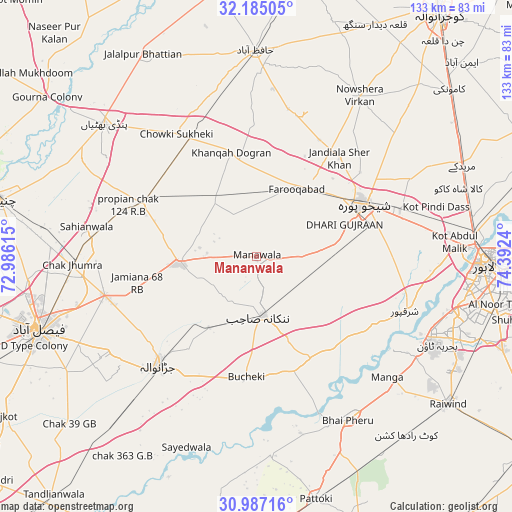
Mananwala GPS coordinates[2]
31° 35' 16.908" North, 73° 41' 21.372" East
| Map corner | latitude | longitude |
|---|---|---|
| Upper-left | 32.18505°, | 72.98615° |
| Center: | 31.58803°, | 73.68927° |
| Lower-right: | 30.98716°, | 74.3924° |
| Map W x H: | 133.2×133.2 km | = 82.8×82.8mi |
| max Lat: | 36.32162° ⇑39.7% North |
| Mananwala: | 31.58803° |
| min Lat: | ⇓60.3% South 24.14422° |
| min Long | Mananwala | max Long |
| 61.74573° | 73.68927° | 75.63372° |
| W 84%⇐ | ⇒16% E |
Elevation
Elevation of Mananwala is 201 m = 659 ft, and this is 144 m = 472 ft below average elevation for this country.
| Max E: |
2732 m = 8963 ft | 41.3% |
| Avg. | 345 m = 1132 ft | |
| Mananwala | 201 m = 659 ft | |
Min E: |
3 m = 10 ft | 58.7% |
See also: Pakistan elevation on elevation.city.
Geographical zone
Mananwala is located in North temperate zone (between Tropic of Cancer and the Arctic Circle). Distance of this Northern Tropic circle is 906.3 km =563.1 mi to South.| Distance of | km | miles | from Mananwala |
|---|---|---|---|
| North Pole | 6494.8 | 4035.7 | to North |
| Arctic Circle | 3888.9 | 2416.4 | to North |
| Tropic Cancer | 906.3 | 563.1 | to South |
| Equator | 3512.3 | 2182.4 | to South |


Nearby cities:
15 places around Mananwala: (largest is in red/bold)
• Chak Five Hundred Seventy-five
14.1 km =8.8 mi,  109°
109°
• Chak Jhumra
48 km =29.8 mi,  267°
267°
• Chuchar-kana Mandi
20.8 km =12.9 mi,  30°
30°
• Jandiala Sher Khan
33.8 km =21 mi,  39°
39°
• Jaranwala
38.2 km =23.7 mi,  222°
222°
• Kaleke Mandi
44 km =27.3 mi,  348°
348°
• Khangah Dogran
28 km =17.4 mi, 346°
• Khurrianwala
41.2 km =25.6 mi,  256°
256°
• Nankana Sahib
15.4 km =9.6 mi,  173°
173°
• Naushahra Virkan
49.4 km =30.7 mi, 32°
• Sangla Hill
32.3 km =20.1 mi,  296°
296°
• Shahkot
19.4 km =12.1 mi, 264°
• Sharqpur Sharif
41.5 km =25.8 mi, 109°
• Shekhupura
31.3 km =19.4 mi,  63°
63°
• Sukheke Mandi
35.3 km =21.9 mi,  331°
331°
Sources, notices
• [Note1] Compared only with cities in Pakistan existing in our database
• [Src1] Map data: © OpenStreetMap contributors (CC-BY-SA)
• [Src2] Other city data from geonames.org with taken over terms of usage.
• [Src3] Geographical zone / Annual Mean Temperature by Robert A. Rohde @ Wikipedia
