Ormara geodata
Ormara (Balochistan) is a populated place; located in Pakistan in Asia/Karachi (GMT+5) time zone. With population of 13,026 people, there are 333 cities with bigger population in this country. Compared to other cities in Pakistan, 93.2% of cities are located further ↑North; 98.6% of cities are located further →East and 99.1% of cities have higher elevation than Ormara. Note1


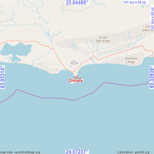
Ormara GPS coordinates[2]
25° 12' 36.648" North, 64° 38' 10.536" East
| Map corner | latitude | longitude |
|---|---|---|
| Upper-left | 25.84466°, | 63.93314° |
| Center: | 25.21018°, | 64.63626° |
| Lower-right: | 24.57237°, | 65.33939° |
| Map W x H: | 141.5×141.5 km | = 87.9×87.9mi |
| max Lat: | 36.32162° ⇑93.2% North |
| Ormara: | 25.21018° |
| min Lat: | ⇓6.8% South 24.14422° |
| min Long | Ormara | max Long |
| 61.74573° | 64.63626° | 75.63372° |
| W 1.4%⇐ | ⇒98.6% E |
Elevation
Elevation of Ormara is 7 m = 23 ft, and this is 338 m = 1109 ft below average elevation for this country.
| Max E: |
2732 m = 8963 ft | 99.1% |
| Avg. | 345 m = 1132 ft | |
| Ormara | 7 m = 23 ft | |
Min E: |
3 m = 10 ft | 0.9% |
See also: Pakistan elevation on elevation.city.
Geographical zone
Ormara is located in North temperate zone (between Tropic of Cancer and the Arctic Circle). Distance of this Northern Tropic circle is 197.2 km =122.5 mi to South.| Distance of | km | miles | from Ormara |
|---|---|---|---|
| North Pole | 7204 | 4476.4 | to North |
| Arctic Circle | 4598.1 | 2857.1 | to North |
| Tropic Cancer | 197.2 | 122.5 | to South |
| Equator | 2803.1 | 1741.8 | to South |


Nearby cities:
15 places around Ormara: (largest is in red/bold)
• Awaran
150.9 km =93.8 mi,  23°
23°
• Bela
202.4 km =125.8 mi,  56°
56°
• Gadani
211.2 km =131.2 mi,  92°
92°
• Gharo
301.8 km =187.5 mi,  99°
99°
• Gwadar
232.8 km =144.7 mi,  267°
267°
• Jiwani
291.5 km =181.1 mi, 266°
• Karachi
242.3 km =150.6 mi, 99°
• Keti Bandar
308.1 km =191.4 mi,  112°
112°
• Malir Cantonment
260.5 km =161.9 mi, 96°
• Mirpur Sakro
310.6 km =193 mi, 103°
• Nooriabad
318.3 km =197.8 mi, 90°
• Panjgur
203.2 km =126.3 mi,  344°
344°
• Pasni
117.5 km =73 mi, 272°
• Turbat
181.9 km =113 mi,  298°
298°
• Uthal
210 km =130.5 mi,  71°
71°
Sources, notices
• [Note1] Compared only with cities in Pakistan existing in our database
• [Src1] Map data: © OpenStreetMap contributors (CC-BY-SA)
• [Src2] Other city data from geonames.org with taken over terms of usage.
• [Src3] Geographical zone / Annual Mean Temperature by Robert A. Rohde @ Wikipedia
