Pasni geodata
Pasni (Balochistan) is a populated place; located in Pakistan in Asia/Karachi (GMT+5) time zone. With population of 33,110 people, there are 191 cities with bigger population in this country. Compared to other cities in Pakistan, 93% of cities are located further ↑North; 99.3% of cities are located further →East and 99.1% of cities have higher elevation than Pasni. Note1


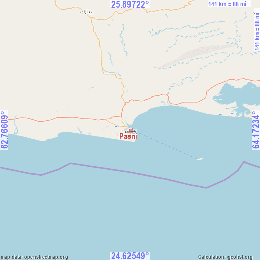
Pasni GPS coordinates[2]
25° 15' 46.872" North, 63° 28' 9.156" East
| Map corner | latitude | longitude |
|---|---|---|
| Upper-left | 25.89722°, | 62.76609° |
| Center: | 25.26302°, | 63.46921° |
| Lower-right: | 24.62549°, | 64.17234° |
| Map W x H: | 141.4×141.4 km | = 87.9×87.9mi |
| max Lat: | 36.32162° ⇑93% North |
| Pasni: | 25.26302° |
| min Lat: | ⇓7% South 24.14422° |
| min Long | Pasni | max Long |
| 61.74573° | 63.46921° | 75.63372° |
| W 0.7%⇐ | ⇒99.3% E |
Elevation
Elevation of Pasni is 7 m = 23 ft, and this is 338 m = 1109 ft below average elevation for this country.
| Max E: |
2732 m = 8963 ft | 99.1% |
| Avg. | 345 m = 1132 ft | |
| Pasni | 7 m = 23 ft | |
Min E: |
3 m = 10 ft | 0.9% |
See also: Pakistan elevation on elevation.city.
Geographical zone
Pasni is located in North temperate zone (between Tropic of Cancer and the Arctic Circle). Distance of this Northern Tropic circle is 203.1 km =126.2 mi to South.| Distance of | km | miles | from Pasni |
|---|---|---|---|
| North Pole | 7198.1 | 4472.7 | to North |
| Arctic Circle | 4592.2 | 2853.5 | to North |
| Tropic Cancer | 203.1 | 126.2 | to South |
| Equator | 2809 | 1745.4 | to South |


Nearby cities:
13 places around Pasni: (largest is in red/bold)
• Awaran
220.7 km =137.1 mi,  53°
53°
• Bela
304.2 km =189 mi,  69°
69°
• Dalbandin
413.6 km =257 mi,  12°
12°
• Gadani
328.7 km =204.2 mi,  92°
92°
• Gwadar
116.2 km =72.2 mi,  262°
262°
• Jiwani
175.1 km =108.8 mi, 262°
• Karachi
359.5 km =223.4 mi,  97°
97°
• Kharan
416.6 km =258.9 mi,  27°
27°
• Malir Cantonment
377.9 km =234.8 mi, 95°
• Ormara
117.5 km =73 mi, 92°
• Panjgur
200 km =124.3 mi,  18°
18°
• Turbat
92.3 km =57.4 mi,  332°
332°
• Uthal
322 km =200.1 mi,  79°
79°
Sources, notices
• [Note1] Compared only with cities in Pakistan existing in our database
• [Src1] Map data: © OpenStreetMap contributors (CC-BY-SA)
• [Src2] Other city data from geonames.org with taken over terms of usage.
• [Src3] Geographical zone / Annual Mean Temperature by Robert A. Rohde @ Wikipedia
