Zawoja geodata
Zawoja (Lesser Poland) is a seat of a third-order administrative division; located in Poland in Europe/Warsaw (GMT+2) time zone. With population of 6,200 people, there are 587 cities with bigger population in this country. Compared to other cities in Poland, 95.9% of cities are located further ↑North; 50.4% of cities are located further →East and 98.4% of cities have lower elevation than Zawoja. Note1


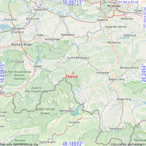
Zawoja GPS coordinates[2]
49° 38' 38.256" North, 19° 32' 32.172" East
| Map corner | latitude | longitude |
|---|---|---|
| Upper-left | 50.09713°, | 18.83915° |
| Center: | 49.64396°, | 19.54227° |
| Lower-right: | 49.18653°, | 20.2454° |
| Map W x H: | 101.2×101.2 km | = 62.9×62.9mi |
| max Lat: | 54.83135° ⇑95.9% North |
| Zawoja: | 49.64396° |
| min Lat: | ⇓4.1% South 49.21328° |
| min Long | Zawoja | max Long |
| 14.20249° | 19.54227° | 24.03723° |
| W 49.6%⇐ | ⇒50.4% E |
Elevation
Elevation of Zawoja is 573 m = 1880 ft, and this is 381.6 m = 1252 ft above average elevation for this country.
| Max E: |
974 m = 3196 ft | 1.6% |
| Zawoja | 573 m 1880 ft | |
| Avg. | 191.4 m = 628 ft | |
Min E: |
-3 m = -10 ft | 98.4% |
See also: Poland elevation on elevation.city.
Geographical zone
Zawoja is located in North temperate zone (between Tropic of Cancer and the Arctic Circle). Distance of this North polar circle is 1881.3 km =1169 mi to North.| Distance of | km | miles | from Zawoja |
|---|---|---|---|
| North Pole | 4487.2 | 2788.2 | to North |
| Arctic Circle | 1881.3 | 1169 | to North |
| Tropic Cancer | 2914 | 1810.7 | to South |
| Equator | 5519.9 | 3429.9 | to South |


Nearby cities:
15 places around Zawoja: (largest is in red/bold)
• Białka
10.7 km =6.6 mi,  59°
59°
• Grzechynia
10.7 km =6.6 mi,  43°
43°
• Juszczyn
12 km =7.5 mi, 63°
• Koszarawa
10.2 km =6.3 mi,  270°
270°
• Krzeszów
13.4 km =8.3 mi,  343°
343°
• Kuków
10.7 km =6.6 mi, 337°
• Kurów
11.6 km =7.2 mi,  318°
318°
• Lachowice
9.3 km =5.8 mi,  328°
328°
• Pewel Wielka
12.5 km =7.8 mi,  285°
285°
• Przyborów
11.5 km =7.1 mi,  257°
257°
• Sidzina
13.5 km =8.4 mi,  115°
115°
• Skawica
6.9 km =4.3 mi, 57°
• Stryszawa
7.8 km =4.8 mi,  349°
349°
• Sucha Beskidzka
11.5 km =7.1 mi,  18°
18°
• Zubrzyca Górna
12 km =7.5 mi,  139°
139°
Sources, notices
• [Note1] Compared only with cities in Poland existing in our database
• [Src1] Map data: © OpenStreetMap contributors (CC-BY-SA)
• [Src2] Other city data from geonames.org with taken over terms of usage.
• [Src3] Geographical zone / Annual Mean Temperature by Robert A. Rohde @ Wikipedia
