Lachowice geodata
Lachowice (Lesser Poland) is a populated place; located in Poland in Europe/Warsaw (GMT+2) time zone. With population of 2,121 people, there are 1403 cities with bigger population in this country. Compared to other cities in Poland, 94.2% of cities are located further ↑North; 51.5% of cities are located further →East and 95.5% of cities have lower elevation than Lachowice. Note1


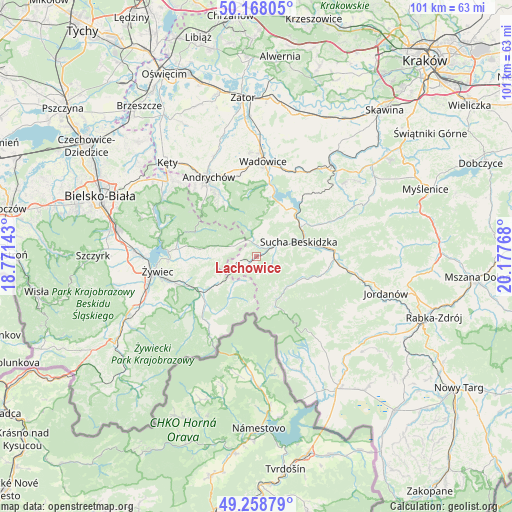
Lachowice GPS coordinates[2]
49° 42' 55.98" North, 19° 28' 28.38" East
| Map corner | latitude | longitude |
|---|---|---|
| Upper-left | 50.16805°, | 18.77143° |
| Center: | 49.71555°, | 19.47455° |
| Lower-right: | 49.25879°, | 20.17768° |
| Map W x H: | 101.1×101.1 km | = 62.8×62.8mi |
| max Lat: | 54.83135° ⇑94.2% North |
| Lachowice: | 49.71555° |
| min Lat: | ⇓5.8% South 49.21328° |
| min Long | Lachowice | max Long |
| 14.20249° | 19.47455° | 24.03723° |
| W 48.5%⇐ | ⇒51.5% E |
Elevation
Elevation of Lachowice is 428 m = 1404 ft, and this is 236.6 m = 776 ft above average elevation for this country.
| Max E: |
974 m = 3196 ft | 4.5% |
| Lachowice | 428 m 1404 ft | |
| Avg. | 191.4 m = 628 ft | |
Min E: |
-3 m = -10 ft | 95.5% |
See also: Poland elevation on elevation.city.
Geographical zone
Lachowice is located in North temperate zone (between Tropic of Cancer and the Arctic Circle). Distance of this North polar circle is 1873.3 km =1164 mi to North.| Distance of | km | miles | from Lachowice |
|---|---|---|---|
| North Pole | 4479.2 | 2783.2 | to North |
| Arctic Circle | 1873.3 | 1164 | to North |
| Tropic Cancer | 2921.9 | 1815.6 | to South |
| Equator | 5527.9 | 3434.9 | to South |


Nearby cities:
15 places around Lachowice: (largest is in red/bold)
• Gilowice
11.8 km =7.3 mi,  268°
268°
• Koszarawa
9.5 km =5.9 mi,  213°
213°
• Krzeszów
5 km =3.1 mi,  12°
12°
• Kuków
2 km =1.2 mi,  21°
21°
• Kurów
2.9 km =1.8 mi,  283°
283°
• Mucharz
11.9 km =7.4 mi,  26°
26°
• Pewel Wielka
8.5 km =5.3 mi,  237°
237°
• Pewel Ślemieńska
10.5 km =6.5 mi,  254°
254°
• Rzyki
12 km =7.5 mi,  332°
332°
• Skawica
11.5 km =7.1 mi,  111°
111°
• Stryszawa
3.4 km =2.1 mi,  94°
94°
• Sucha Beskidzka
9.1 km =5.7 mi,  71°
71°
• Zawoja
9.3 km =5.8 mi,  148°
148°
• Zembrzyce
11.3 km =7 mi,  53°
53°
• Ślemień
7.7 km =4.8 mi, 272°
Sources, notices
• [Note1] Compared only with cities in Poland existing in our database
• [Src1] Map data: © OpenStreetMap contributors (CC-BY-SA)
• [Src2] Other city data from geonames.org with taken over terms of usage.
• [Src3] Geographical zone / Annual Mean Temperature by Robert A. Rohde @ Wikipedia
