Wysoka Lelowska geodata
Wysoka Lelowska (Silesia) is a populated place; located in Poland in Europe/Warsaw (GMT+2) time zone. With population of 702 people, there are 3058 cities with bigger population in this country. Compared to other cities in Poland, 64.3% of cities are located further ↑North; 53.7% of cities are located further →East and 91.5% of cities have lower elevation than Wysoka Lelowska. Note1


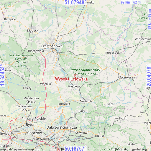
Wysoka Lelowska GPS coordinates[2]
50° 38' 8.304" North, 19° 20' 15.54" East
| Map corner | latitude | longitude |
|---|---|---|
| Upper-left | 51.07948°, | 18.63453° |
| Center: | 50.63564°, | 19.33765° |
| Lower-right: | 50.18757°, | 20.04078° |
| Map W x H: | 99.2×99.2 km | = 61.6×61.6mi |
| max Lat: | 54.83135° ⇑64.3% North |
| Wysoka Lelowska: | 50.63564° |
| min Lat: | ⇓35.7% South 49.21328° |
| min Long | Wysoka Lelowska | max Long |
| 14.20249° | 19.33765° | 24.03723° |
| W 46.3%⇐ | ⇒53.7% E |
Elevation
Elevation of Wysoka Lelowska is 350 m = 1148 ft, and this is 158.6 m = 520 ft above average elevation for this country.
| Max E: |
974 m = 3196 ft | 8.5% |
| Wysoka Lelowska | 350 m 1148 ft | |
| Avg. | 191.4 m = 628 ft | |
Min E: |
-3 m = -10 ft | 91.5% |
See also: Poland elevation on elevation.city.
Geographical zone
Wysoka Lelowska is located in North temperate zone (between Tropic of Cancer and the Arctic Circle). Distance of this North polar circle is 1771 km =1100.4 mi to North.| Distance of | km | miles | from Wysoka Lelowska |
|---|---|---|---|
| North Pole | 4376.9 | 2719.7 | to North |
| Arctic Circle | 1771 | 1100.4 | to North |
| Tropic Cancer | 3024.2 | 1879.2 | to South |
| Equator | 5630.2 | 3498.4 | to South |


Nearby cities:
15 places around Wysoka Lelowska: (largest is in red/bold)
• Choroń
7.5 km =4.7 mi,  313°
313°
• Góra Włodowska
10.2 km =6.3 mi,  130°
130°
• Janów
11.8 km =7.3 mi,  34°
34°
• Jastrząb
11.6 km =7.2 mi,  289°
289°
• Jaworznik
5.8 km =3.6 mi,  121°
121°
• Lgota Górna
7.8 km =4.8 mi,  239°
239°
• Myszków
6.8 km =4.2 mi,  187°
187°
• Niegowa
10.3 km =6.4 mi,  86°
86°
• Poraj
9.8 km =6.1 mi,  298°
298°
• Potok Złoty
10.3 km =6.4 mi,  39°
39°
• Przybynów
2.4 km =1.5 mi,  323°
323°
• Siedlec
6.7 km =4.2 mi,  16°
16°
• Włodowice
12 km =7.5 mi,  137°
137°
• Żarki
2.2 km =1.4 mi, 122°
• Żarki-Letnisko
4.6 km =2.9 mi,  252°
252°
Sources, notices
• [Note1] Compared only with cities in Poland existing in our database
• [Src1] Map data: © OpenStreetMap contributors (CC-BY-SA)
• [Src2] Other city data from geonames.org with taken over terms of usage.
• [Src3] Geographical zone / Annual Mean Temperature by Robert A. Rohde @ Wikipedia
