Wróblówka geodata
Wróblówka (Lesser Poland) is a populated place; located in Poland in Europe/Warsaw (GMT+2) time zone. With population of 557 people, there are 3392 cities with bigger population in this country. Compared to other cities in Poland, 99% of cities are located further ↑North; 56.7% of cities are located further ←West and 99.2% of cities have lower elevation than Wróblówka. Note1
Administrative division(s):
- Level 1: Lesser Poland
- Level 2: Powiat nowotarski
- Level 3: Czarny Dunajec


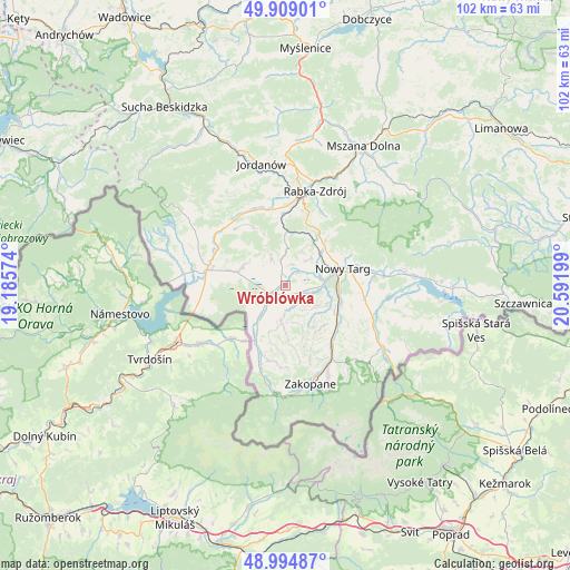
Wróblówka GPS coordinates[2]
49° 27' 14.652" North, 19° 53' 19.896" East
| Map corner | latitude | longitude |
|---|---|---|
| Upper-left | 49.90901°, | 19.18574° |
| Center: | 49.45407°, | 19.88886° |
| Lower-right: | 48.99487°, | 20.59199° |
| Map W x H: | 101.6×101.6 km | = 63.1×63.1mi |
| max Lat: | 54.83135° ⇑99% North |
| Wróblówka: | 49.45407° |
| min Lat: | ⇓1% South 49.21328° |
| min Long | Wróblówka | max Long |
| 14.20249° | 19.88886° | 24.03723° |
| W 56.7%⇐ | ⇒43.3% E |
Elevation
Elevation of Wróblówka is 646 m = 2119 ft, and this is 454.6 m = 1491 ft above average elevation for this country.
| Max E: |
974 m = 3196 ft | 0.8% |
| Wróblówka | 646 m 2119 ft | |
| Avg. | 191.4 m = 628 ft | |
Min E: |
-3 m = -10 ft | 99.2% |
See also: Poland elevation on elevation.city.
Geographical zone
Wróblówka is located in North temperate zone (between Tropic of Cancer and the Arctic Circle). Distance of this North polar circle is 1902.4 km =1182.1 mi to North.| Distance of | km | miles | from Wróblówka |
|---|---|---|---|
| North Pole | 4508.3 | 2801.3 | to North |
| Arctic Circle | 1902.4 | 1182.1 | to North |
| Tropic Cancer | 2892.9 | 1797.6 | to South |
| Equator | 5498.8 | 3416.8 | to South |


Nearby cities:
15 places around Wróblówka: (largest is in red/bold)
• Czarny Dunajec
3.3 km =2.1 mi,  234°
234°
• Harkabuz
10.1 km =6.3 mi,  337°
337°
• Klikuszowa
10 km =6.2 mi,  43°
43°
• Krauszów
5.4 km =3.4 mi,  64°
64°
• Lasek
9 km =5.6 mi,  47°
47°
• Ludźmierz
6.9 km =4.3 mi,  78°
78°
• Nowy Targ
10.7 km =6.6 mi, 75°
• Odrowąż
5.4 km =3.4 mi,  331°
331°
• Piekielnik
9.1 km =5.7 mi,  286°
286°
• Pieniążkowice
4.9 km =3 mi,  352°
352°
• Pyzówka
7.6 km =4.7 mi,  27°
27°
• Sieniawa
10 km =6.2 mi,  17°
17°
• Szaflary
10.5 km =6.5 mi,  107°
107°
• Trute
7.1 km =4.4 mi, 53°
• Załuczne
6.7 km =4.2 mi,  309°
309°
Sources, notices
• [Note1] Compared only with cities in Poland existing in our database
• [Src1] Map data: © OpenStreetMap contributors (CC-BY-SA)
• [Src2] Other city data from geonames.org with taken over terms of usage.
• [Src3] Geographical zone / Annual Mean Temperature by Robert A. Rohde @ Wikipedia
