Władysławowo geodata
Władysławowo (Pomerania) is a seat of a third-order administrative division; located in Poland in Europe/Warsaw (GMT+2) time zone. With population of 14,889 people, there are 335 cities with bigger population in this country. Compared to other cities in Poland, 99.9% of cities are located further ↓South; 69.7% of cities are located further →East and 97.3% of cities have higher elevation than Władysławowo. Note1


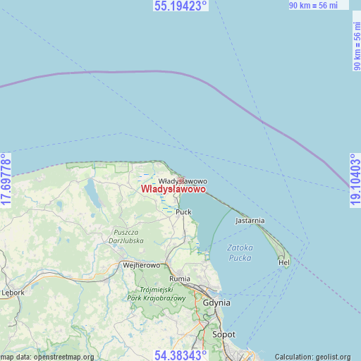
Władysławowo GPS coordinates[2]
54° 47' 27.096" North, 18° 24' 3.24" East
| Map corner | latitude | longitude |
|---|---|---|
| Upper-left | 55.19423°, | 17.69778° |
| Center: | 54.79086°, | 18.4009° |
| Lower-right: | 54.38343°, | 19.10403° |
| Map W x H: | 90.2×90.2 km | = 56×56mi |
| max Lat: | 54.83135° ⇑0.1% North |
| Władysławowo: | 54.79086° |
| min Lat: | ⇓99.9% South 49.21328° |
| min Long | Władysławowo | max Long |
| 14.20249° | 18.4009° | 24.03723° |
| W 30.3%⇐ | ⇒69.7% E |
Elevation
Elevation of Władysławowo is 19 m = 62 ft, and this is 172.4 m = 566 ft below average elevation for this country.
| Max E: |
974 m = 3196 ft | 97.3% |
| Avg. | 191.4 m = 628 ft | |
| Władysławowo | 19 m = 62 ft | |
Min E: |
-3 m = -10 ft | 2.7% |
See also: Poland elevation on elevation.city.
Geographical zone
Władysławowo is located in North temperate zone (between Tropic of Cancer and the Arctic Circle). Distance of this North polar circle is 1309 km =813.4 mi to North.| Distance of | km | miles | from Władysławowo |
|---|---|---|---|
| North Pole | 3914.9 | 2432.6 | to North |
| Arctic Circle | 1309 | 813.4 | to North |
| Tropic Cancer | 3486.3 | 2166.3 | to South |
| Equator | 6092.2 | 3785.5 | to South |


Nearby cities:
15 places around Władysławowo: (largest is in red/bold)
• Chłapowo
2.3 km =1.4 mi,  309°
309°
• Gnieżdżewo
5 km =3.1 mi,  195°
195°
• Jastarnia
20.7 km =12.9 mi,  120°
120°
• Jastrzębia Góra
7.2 km =4.5 mi, 308°
• Karwia
12.9 km =8 mi,  289°
289°
• Krokowa
15.4 km =9.6 mi,  265°
265°
• Mosty
20.8 km =12.9 mi,  162°
162°
• Mrzezino
15.4 km =9.6 mi,  172°
172°
• Ostrowo
10.8 km =6.7 mi, 290°
• Puck
8.1 km =5 mi,  176°
176°
• Rekowo Dolne
17.9 km =11.1 mi,  187°
187°
• Rewa
18.9 km =11.7 mi, 158°
• Strzelno
4.9 km =3 mi,  263°
263°
• Swarzewo
3.2 km =2 mi, 183°
• Żelistrzewo
12.6 km =7.8 mi, 175°
Sources, notices
• [Note1] Compared only with cities in Poland existing in our database
• [Src1] Map data: © OpenStreetMap contributors (CC-BY-SA)
• [Src2] Other city data from geonames.org with taken over terms of usage.
• [Src3] Geographical zone / Annual Mean Temperature by Robert A. Rohde @ Wikipedia
