Krokowa geodata
Krokowa (Pomerania) is a seat of a third-order administrative division; located in Poland in Europe/Warsaw (GMT+2) time zone. With population of 782 people, there are 2894 cities with bigger population in this country. Compared to other cities in Poland, 99.8% of cities are located further ↓South; 73.2% of cities are located further →East and 97.9% of cities have higher elevation than Krokowa. Note1


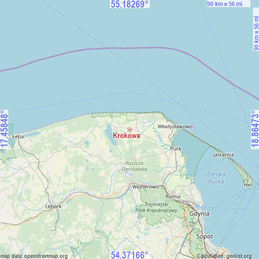
Krokowa GPS coordinates[2]
54° 46' 45.156" North, 18° 9' 41.76" East
| Map corner | latitude | longitude |
|---|---|---|
| Upper-left | 55.18269°, | 17.45848° |
| Center: | 54.77921°, | 18.1616° |
| Lower-right: | 54.37166°, | 18.86473° |
| Map W x H: | 90.2×90.2 km | = 56×56mi |
| max Lat: | 54.83135° ⇑0.2% North |
| Krokowa: | 54.77921° |
| min Lat: | ⇓99.8% South 49.21328° |
| min Long | Krokowa | max Long |
| 14.20249° | 18.1616° | 24.03723° |
| W 26.8%⇐ | ⇒73.2% E |
Elevation
Elevation of Krokowa is 16 m = 52 ft, and this is 175.4 m = 575 ft below average elevation for this country.
| Max E: |
974 m = 3196 ft | 97.9% |
| Avg. | 191.4 m = 628 ft | |
| Krokowa | 16 m = 52 ft | |
Min E: |
-3 m = -10 ft | 2.1% |
See also: Poland elevation on elevation.city.
Geographical zone
Krokowa is located in North temperate zone (between Tropic of Cancer and the Arctic Circle). Distance of this North polar circle is 1310.3 km =814.2 mi to North.| Distance of | km | miles | from Krokowa |
|---|---|---|---|
| North Pole | 3916.2 | 2433.4 | to North |
| Arctic Circle | 1310.3 | 814.2 | to North |
| Tropic Cancer | 3485 | 2165.5 | to South |
| Equator | 6090.9 | 3784.7 | to South |


Nearby cities:
15 places around Krokowa: (largest is in red/bold)
• Bolszewo
17.9 km =11.1 mi,  177°
177°
• Chłapowo
13.9 km =8.6 mi,  78°
78°
• Gniewino
11.6 km =7.2 mi,  233°
233°
• Gnieżdżewo
14.4 km =8.9 mi,  104°
104°
• Góra
16.6 km =10.3 mi,  190°
190°
• Jastrzębia Góra
11.3 km =7 mi,  59°
59°
• Karwia
6.3 km =3.9 mi,  29°
29°
• Orle
15.5 km =9.6 mi, 177°
• Ostrowo
7.4 km =4.6 mi,  45°
45°
• Puck
17.2 km =10.7 mi,  113°
113°
• Rybno
11.7 km =7.3 mi,  204°
204°
• Strzelno
10.5 km =6.5 mi,  86°
86°
• Swarzewo
15.3 km =9.5 mi, 97°
• Wierzchucino
10.2 km =6.3 mi,  275°
275°
• Władysławowo
15.4 km =9.6 mi, 85°
Sources, notices
• [Note1] Compared only with cities in Poland existing in our database
• [Src1] Map data: © OpenStreetMap contributors (CC-BY-SA)
• [Src2] Other city data from geonames.org with taken over terms of usage.
• [Src3] Geographical zone / Annual Mean Temperature by Robert A. Rohde @ Wikipedia
