Gnieżdżewo geodata
Gnieżdżewo (Pomerania) is a populated place; located in Poland in Europe/Warsaw (GMT+2) time zone. With population of 1,113 people, there are 2291 cities with bigger population in this country. Compared to other cities in Poland, 99.7% of cities are located further ↓South; 70.2% of cities are located further →East and 98.1% of cities have higher elevation than Gnieżdżewo. Note1


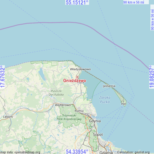
Gnieżdżewo GPS coordinates[2]
54° 44' 50.676" North, 18° 22' 45.984" East
| Map corner | latitude | longitude |
|---|---|---|
| Upper-left | 55.15121°, | 17.67632° |
| Center: | 54.74741°, | 18.37944° |
| Lower-right: | 54.33954°, | 19.08257° |
| Map W x H: | 90.2×90.2 km | = 56×56mi |
| max Lat: | 54.83135° ⇑0.3% North |
| Gnieżdżewo: | 54.74741° |
| min Lat: | ⇓99.7% South 49.21328° |
| min Long | Gnieżdżewo | max Long |
| 14.20249° | 18.37944° | 24.03723° |
| W 29.8%⇐ | ⇒70.2% E |
Elevation
Elevation of Gnieżdżewo is 13 m = 43 ft, and this is 178.4 m = 585 ft below average elevation for this country.
| Max E: |
974 m = 3196 ft | 98.1% |
| Avg. | 191.4 m = 628 ft | |
| Gnieżdżewo | 13 m = 43 ft | |
Min E: |
-3 m = -10 ft | 1.9% |
See also: Poland elevation on elevation.city.
Geographical zone
Gnieżdżewo is located in North temperate zone (between Tropic of Cancer and the Arctic Circle). Distance of this North polar circle is 1313.8 km =816.4 mi to North.| Distance of | km | miles | from Gnieżdżewo |
|---|---|---|---|
| North Pole | 3919.7 | 2435.6 | to North |
| Arctic Circle | 1313.8 | 816.4 | to North |
| Tropic Cancer | 3481.4 | 2163.2 | to South |
| Equator | 6087.3 | 3782.5 | to South |


Nearby cities:
15 places around Gnieżdżewo: (largest is in red/bold)
• Chłapowo
6.3 km =3.9 mi,  356°
356°
• Jastrzębia Góra
10.3 km =6.4 mi,  335°
335°
• Karwia
14.1 km =8.8 mi,  309°
309°
• Krokowa
14.4 km =8.9 mi,  284°
284°
• Mosty
16.8 km =10.4 mi,  153°
153°
• Mrzezino
10.9 km =6.8 mi,  162°
162°
• Ostrowo
12.3 km =7.6 mi, 314°
• Puck
3.8 km =2.4 mi, 150°
• Reda
15.9 km =9.9 mi,  187°
187°
• Rekowo Dolne
13 km =8.1 mi,  184°
184°
• Rewa
15.2 km =9.4 mi, 146°
• Strzelno
5.5 km =3.4 mi,  320°
320°
• Swarzewo
2 km =1.2 mi,  35°
35°
• Władysławowo
5 km =3.1 mi,  15°
15°
• Żelistrzewo
8.1 km =5 mi, 162°
Sources, notices
• [Note1] Compared only with cities in Poland existing in our database
• [Src1] Map data: © OpenStreetMap contributors (CC-BY-SA)
• [Src2] Other city data from geonames.org with taken over terms of usage.
• [Src3] Geographical zone / Annual Mean Temperature by Robert A. Rohde @ Wikipedia
