Trzebiechów geodata
Trzebiechów (Lubusz) is a seat of a third-order administrative division; located in Poland in Europe/Warsaw (GMT+2) time zone. With population of 920 people, there are 2637 cities with bigger population in this country. Compared to other cities in Poland, 66% of cities are located further ↓South; 94% of cities are located further →East and 94% of cities have higher elevation than Trzebiechów. Note1


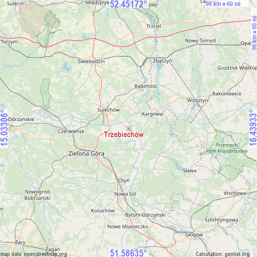
Trzebiechów GPS coordinates[2]
52° 1' 16.068" North, 15° 44' 10.32" East
| Map corner | latitude | longitude |
|---|---|---|
| Upper-left | 52.45172°, | 15.03308° |
| Center: | 52.02113°, | 15.7362° |
| Lower-right: | 51.58635°, | 16.43933° |
| Map W x H: | 96.2×96.2 km | = 59.8×59.8mi |
| max Lat: | 54.83135° ⇑34% North |
| Trzebiechów: | 52.02113° |
| min Lat: | ⇓66% South 49.21328° |
| min Long | Trzebiechów | max Long |
| 14.20249° | 15.7362° | 24.03723° |
| W 6%⇐ | ⇒94% E |
Elevation
Elevation of Trzebiechów is 54 m = 177 ft, and this is 137.4 m = 451 ft below average elevation for this country.
| Max E: |
974 m = 3196 ft | 94% |
| Avg. | 191.4 m = 628 ft | |
| Trzebiechów | 54 m = 177 ft | |
Min E: |
-3 m = -10 ft | 6% |
See also: Poland elevation on elevation.city.
Geographical zone
Trzebiechów is located in North temperate zone (between Tropic of Cancer and the Arctic Circle). Distance of this North polar circle is 1617 km =1004.8 mi to North.| Distance of | km | miles | from Trzebiechów |
|---|---|---|---|
| North Pole | 4222.9 | 2624 | to North |
| Arctic Circle | 1617 | 1004.8 | to North |
| Tropic Cancer | 3178.3 | 1974.9 | to South |
| Equator | 5784.2 | 3594.1 | to South |


Nearby cities:
15 places around Trzebiechów: (largest is in red/bold)
• Babimost
17.2 km =10.7 mi,  21°
21°
• Bobrowniki
17.4 km =10.8 mi,  180°
180°
• Bojadła
9.1 km =5.7 mi,  146°
146°
• Cigacice
8.6 km =5.3 mi,  281°
281°
• Kargowa
10.2 km =6.3 mi,  56°
56°
• Kije
15.9 km =9.9 mi,  302°
302°
• Klenica
4.6 km =2.9 mi,  134°
134°
• Kolsko
16.7 km =10.4 mi,  113°
113°
• Konotop
15.2 km =9.4 mi, 130°
• Lubięcin
17.4 km =10.8 mi, 146°
• Otyń
19.4 km =12.1 mi,  185°
185°
• Sulechów
10.3 km =6.4 mi,  312°
312°
• Swarzynice
2.5 km =1.6 mi, 154°
• Zabór
7.8 km =4.8 mi, 189°
• Zielona Góra
18.4 km =11.4 mi,  238°
238°
Sources, notices
• [Note1] Compared only with cities in Poland existing in our database
• [Src1] Map data: © OpenStreetMap contributors (CC-BY-SA)
• [Src2] Other city data from geonames.org with taken over terms of usage.
• [Src3] Geographical zone / Annual Mean Temperature by Robert A. Rohde @ Wikipedia
