Sieciechowice geodata
Sieciechowice (Lesser Poland) is a populated place; located in Poland in Europe/Warsaw (GMT+2) time zone. With population of 979 people, there are 2540 cities with bigger population in this country. Compared to other cities in Poland, 73.3% of cities are located further ↑North; 57.9% of cities are located further ←West and 83.2% of cities have lower elevation than Sieciechowice. Note1


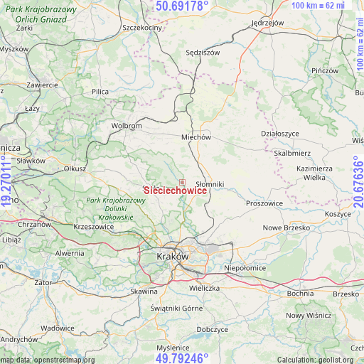
Sieciechowice GPS coordinates[2]
50° 14' 39.264" North, 19° 58' 23.628" East
| Map corner | latitude | longitude |
|---|---|---|
| Upper-left | 50.69178°, | 19.27011° |
| Center: | 50.24424°, | 19.97323° |
| Lower-right: | 49.79246°, | 20.67636° |
| Map W x H: | 100×100 km | = 62.1×62.1mi |
| max Lat: | 54.83135° ⇑73.3% North |
| Sieciechowice: | 50.24424° |
| min Lat: | ⇓26.7% South 49.21328° |
| min Long | Sieciechowice | max Long |
| 14.20249° | 19.97323° | 24.03723° |
| W 57.9%⇐ | ⇒42.1% E |
Elevation
Elevation of Sieciechowice is 281 m = 922 ft, and this is 89.6 m = 294 ft above average elevation for this country.
| Max E: |
974 m = 3196 ft | 16.8% |
| Sieciechowice | 281 m 922 ft | |
| Avg. | 191.4 m = 628 ft | |
Min E: |
-3 m = -10 ft | 83.2% |
See also: Poland elevation on elevation.city.
Geographical zone
Sieciechowice is located in North temperate zone (between Tropic of Cancer and the Arctic Circle). Distance of this North polar circle is 1814.5 km =1127.5 mi to North.| Distance of | km | miles | from Sieciechowice |
|---|---|---|---|
| North Pole | 4420.4 | 2746.7 | to North |
| Arctic Circle | 1814.5 | 1127.5 | to North |
| Tropic Cancer | 2980.7 | 1852.1 | to South |
| Equator | 5586.6 | 3471.4 | to South |


Nearby cities:
15 places around Sieciechowice: (largest is in red/bold)
• Baranówka
14.4 km =8.9 mi,  140°
140°
• Bębło
15 km =9.3 mi,  241°
241°
• Giebułtów
12.9 km =8 mi,  211°
211°
• Iwanowice
2.2 km =1.4 mi,  202°
202°
• Masłomiąca
9.4 km =5.8 mi,  167°
167°
• Michałowice
9.5 km =5.9 mi,  176°
176°
• Miechów
13.1 km =8.1 mi,  17°
17°
• Miłocice
5.1 km =3.2 mi,  103°
103°
• Modlnica
14.9 km =9.3 mi, 211°
• Niedźwiedź
8.8 km =5.5 mi, 104°
• Skała
8.6 km =5.3 mi,  259°
259°
• Sąspów
14.5 km =9 mi, 263°
• Słomniki
7.8 km =4.8 mi,  93°
93°
• Wielka Wieś
13.4 km =8.3 mi,  223°
223°
• Zielonki
14.2 km =8.8 mi, 195°
Sources, notices
• [Note1] Compared only with cities in Poland existing in our database
• [Src1] Map data: © OpenStreetMap contributors (CC-BY-SA)
• [Src2] Other city data from geonames.org with taken over terms of usage.
• [Src3] Geographical zone / Annual Mean Temperature by Robert A. Rohde @ Wikipedia
