Rybnik geodata
Rybnik (Silesia) is a seat of a second-order administrative division; located in Poland in Europe/Warsaw (GMT+2) time zone. With population of 142,510 people, there are 28 cities with bigger population in this country. Compared to other cities in Poland, 78.1% of cities are located further ↑North; 67.4% of cities are located further →East and 71.4% of cities have lower elevation than Rybnik. Note1


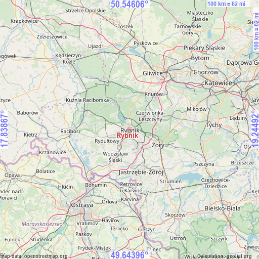
Rybnik GPS coordinates[2]
50° 5' 49.668" North, 18° 32' 30.444" East
| Map corner | latitude | longitude |
|---|---|---|
| Upper-left | 50.54606°, | 17.83867° |
| Center: | 50.09713°, | 18.54179° |
| Lower-right: | 49.64396°, | 19.24492° |
| Map W x H: | 100.3×100.3 km | = 62.3×62.3mi |
| max Lat: | 54.83135° ⇑78.1% North |
| Rybnik: | 50.09713° |
| min Lat: | ⇓21.9% South 49.21328° |
| min Long | Rybnik | max Long |
| 14.20249° | 18.54179° | 24.03723° |
| W 32.6%⇐ | ⇒67.4% E |
Elevation
Elevation of Rybnik is 233 m = 764 ft, and this is 41.6 m = 136 ft above average elevation for this country.
| Max E: |
974 m = 3196 ft | 28.6% |
| Rybnik | 233 m 764 ft | |
| Avg. | 191.4 m = 628 ft | |
Min E: |
-3 m = -10 ft | 71.4% |
See also: Rybnik elevation on elevation.city.
Geographical zone
Rybnik is located in North temperate zone (between Tropic of Cancer and the Arctic Circle). Distance of this North polar circle is 1830.9 km =1137.7 mi to North.| Distance of | km | miles | from Rybnik |
|---|---|---|---|
| North Pole | 4436.8 | 2756.9 | to North |
| Arctic Circle | 1830.9 | 1137.7 | to North |
| Tropic Cancer | 2964.4 | 1842 | to South |
| Equator | 5570.3 | 3461.2 | to South |


Nearby cities:
15 places around Rybnik: (largest is in red/bold)
• Czernica
10.2 km =6.3 mi,  261°
261°
• Gaszowice
8 km =5 mi,  279°
279°
• Jankowice Rybnickie
5.8 km =3.6 mi,  176°
176°
• Jejkowice
5.4 km =3.4 mi, 283°
• Książenice
7.7 km =4.8 mi,  32°
32°
• Markłowice
9 km =5.6 mi,  189°
189°
• Niedobczyce
4.8 km =3 mi,  223°
223°
• Radlin
7 km =4.3 mi, 221°
• Rydułtowy
9.9 km =6.2 mi,  244°
244°
• Stanowice
9.9 km =6.2 mi,  68°
68°
• Szczerbice
6.6 km =4.1 mi,  267°
267°
• Wilcza
10.9 km =6.8 mi,  20°
20°
• Zebrzydowice
3 km =1.9 mi, 276°
• Świerklany Dolne
9.1 km =5.7 mi,  163°
163°
• Świerklany Górne
8.5 km =5.3 mi, 155°
Sources, notices
• [Note1] Compared only with cities in Poland existing in our database
• [Src1] Map data: © OpenStreetMap contributors (CC-BY-SA)
• [Src2] Other city data from geonames.org with taken over terms of usage.
• [Src3] Geographical zone / Annual Mean Temperature by Robert A. Rohde @ Wikipedia
